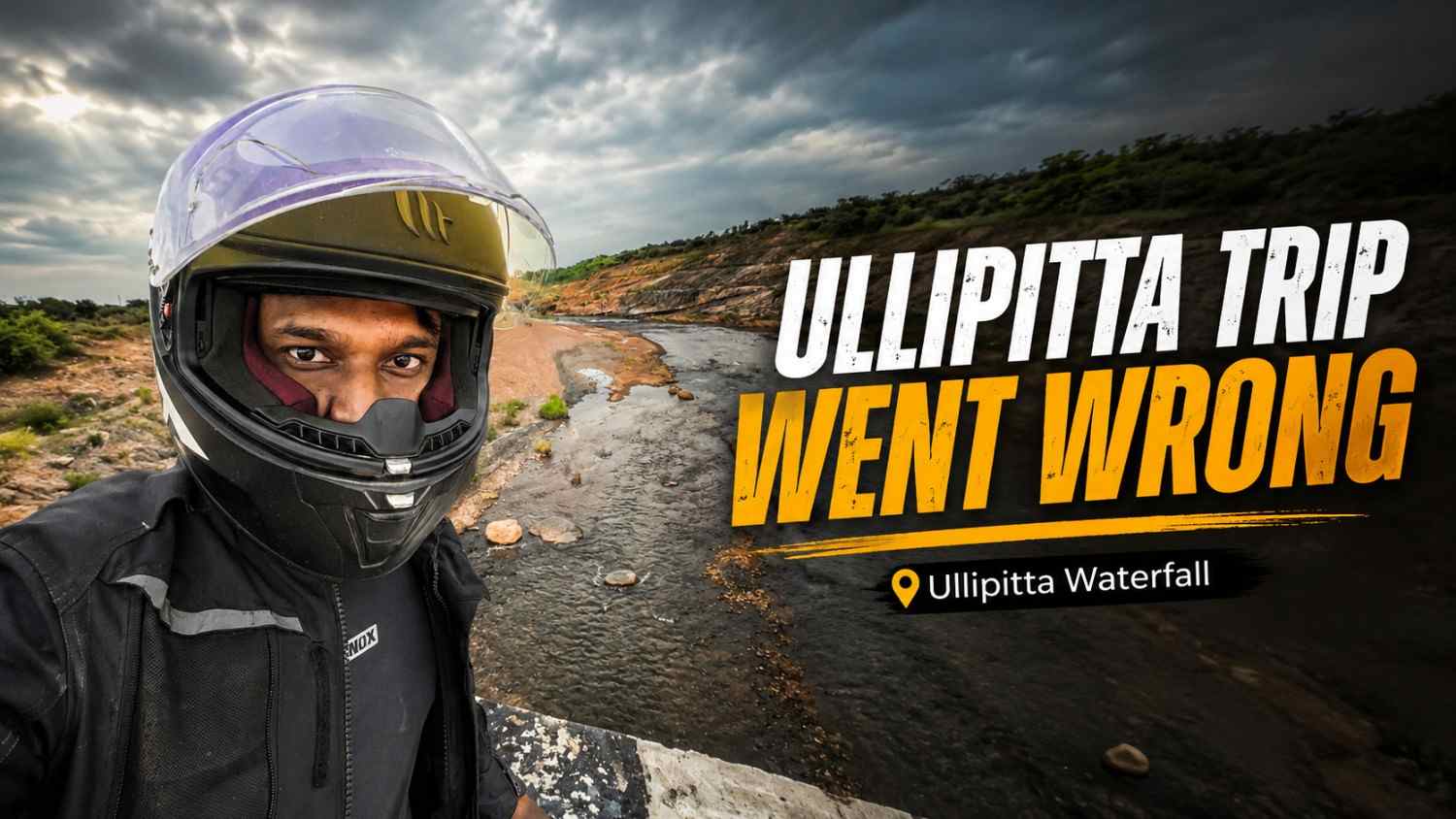
Ullipitta Waterfall: My 151 KM Ride With No Water
Sometimes a trip goes exactly as planned.
And sometimes you ride 151 km to Ullipitta Waterfall, cross roads soaked by heavy rain, enjoy some of the best green scenery of the journey and finally reach the destination only to discover one problem.
There is almost no waterfall.
That is exactly what happened to me on my solo ride to Ullipitta Waterfall in Telangana.
I discovered this waterfall while randomly scrolling through Instagram Reels. I had already visited several waterfalls around Telangana, but whenever I see a lesser-known waterfall that looks interesting, the first thing I normally do is save the location and start checking the route.
Ullipitta Waterfall looked like another good weekend destination.
So the plan was fixed.
What I did not know at that point was that this trip would eventually become one of the most tiring and frustrating trips I had experienced.
But before everything went wrong, the ride itself was actually beautiful.
Ullipitta Waterfall Quick Information
| Information | Details |
| Waterfall | Ullipitta Waterfall |
| Village | Ullipitta Dorli |
| Mandal | Tiryani |
| District | Kumuram Bheem Asifabad |
| State | Telangana |
| PIN Code | 504294 |
| Type | Seasonal waterfall |
| Best season | Monsoon, especially after consistent rainfall |
| Karimnagar to Ullipitta Waterfall | Around 151 km on my route |
| My travel time | Around 3 hours 30 minutes |
| Entry fee during my visit | Free |
| Parking fee during my visit | Free |
| Recommended vehicle | Bike or car |
| Best time of day | Morning to afternoon |
| Main attraction | Seasonal waterfall, forest scenery and peaceful surroundings |
Ullipitta Dorli is officially located in Tiryani Mandal of Kumuram Bheem Asifabad district, Telangana. Some older travel websites still mention Adilabad because the area was historically associated with the old Adilabad district, so this can create confusion while researching the location.
Ullipitta is also a seasonal waterfall, so the amount of water depends heavily on rainfall in its actual catchment area. Telangana waterfall directories generally recommend the monsoon period for waterfalls in this belt, with July to September usually providing the strongest conditions.
And this is one thing I learned the hard way.
Seeing heavy rain 30 or 40 km away does not mean the waterfall itself will have good water flow.
For better understanding of Ullipitta Waterfall and the surrounding waterfall belt in Kumuram Bheem Asifabad district, I also referred to Telangana360.com, which covers several seasonal waterfalls across Telangana. Their regional information helped me cross-check the monsoon season, nearby waterfall locations, and general travel context while preparing this guide.
Where Is Ullipitta Waterfall?
Ullipitta Waterfall is located near Ullipitta Dorli village in Tiryani Mandal, Kumuram Bheem Asifabad district of Telangana.
The area falls in northern Telangana and is surrounded by forests, villages and coal-mining regions.
Ullipitta Dorli is listed as a village under Tiryani Mandal, and Bellampalle is one of the major towns accessible from this side of the district.
The region itself has several lesser-known waterfalls. Ullipitta, Thiryani, Chechera, Gundala and a number of other seasonal waterfalls are spread across the wider Asifabad forest belt.
That is one reason this part of Telangana becomes very interesting during the monsoon.
How I Discovered Ullipitta Waterfall?
Like many of my recent trips, this one also started with Instagram.
I was randomly scrolling through Reels when a video of Ullipitta Waterfall appeared.
The place immediately caught my attention.
I opened Google Maps and started doing my usual research:
- Where exactly is Ullipitta Waterfall?
- How far is it from Karimnagar?
- What road should I take?
- Can I complete it as a one-day trip?
- Is the road suitable for my bike?
- Are there any other places nearby?
From my home in Karimnagar, Google Maps showed roughly 151 km, with a travel time of around 3 hours 30 minutes.
For me, that was perfect for a Saturday ride.
Not too close.
Not extremely far.
And long enough to properly enjoy the motorcycle journey.
So again, I started waiting for the weekend.
Preparing My Bike Before the Trip
Friday has almost become preparation day whenever I plan a Saturday ride.
I cleaned my bike, checked everything needed for the journey and cleaned my riding gear.
For a long ride, I prefer preparing everything the previous day rather than searching for gloves, rain gear or other things early in the morning.
The route I planned was:
Karimnagar → Peddapalli → Ramagundam → Bellampalle → Tandur → Golleti → Sonapur side → Ullipitta Waterfall
The main highway section looked straightforward.
The unknown part for me was the last stretch after Tandur.
That is usually the interesting part of visiting lesser-known places.
Highways are predictable.
Village roads are where the actual trip begins.
Starting From Karimnagar at 6 AM
On Saturday morning, I woke up early, got ready and started from Karimnagar at around 6:00 AM.
The weather was already giving proper monsoon vibes.
My plan was simple.
Reach Ullipitta Waterfall in the morning, spend some time there and then decide whether I should visit another nearby place before returning home.
The first section towards Peddapalli and Ramagundam went smoothly.
The roads were good and traffic was manageable because I had started early.
Everything was going exactly according to plan.
Until I reached Ramagundam.
Rain Started Near Ramagundam
Near Ramagundam, light rain started.
Initially it was nothing serious.
But because I still had a long distance remaining, I stopped and wore my raincoat before continuing.
A few drops of rain on a long ride can quickly turn into a proper downpour, especially during the Telangana monsoon.
And that is exactly what happened.
As I moved towards the Bellampalle section, the rain suddenly became extremely heavy.
Heavy Rain Near Bellampalle
At one point, visibility through my helmet became so poor that continuing at normal speed did not make sense.
Rainwater was hitting the visor continuously.
The road ahead was becoming difficult to see.
So I slowed down my bike, pulled over safely beside the highway and waited.
I thought:
“Maybe ten minutes. The rain will slow down.”
It did not.
I kept waiting, but the rain continued with almost the same intensity.
Eventually I realised I could either keep standing there indefinitely or continue very slowly.
So I decided to ride carefully.
I reduced my speed and continued through the rain.
After travelling roughly another 10 km, the weather suddenly changed.
No rain.
That is monsoon travel for you.
One stretch looks like somebody has opened a giant shower over the highway and a few kilometres later the road is completely dry from the sky.
Riding Through Roads Covered With Rainwater
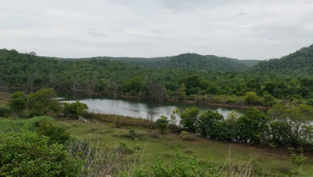
Although the rain had stopped, it was obvious that the area ahead had also received heavy rainfall earlier.
There was water all over parts of the road.
The surroundings were completely fresh.
Trees looked greener.
Small water bodies had formed beside the road.
Clouds covered the sky.
And after struggling through the heavy rainfall near Bellampalle, this section became one of my favourite parts of the ride.
I genuinely enjoyed riding through it.
This is the strange thing about motorcycle trips.
The same rain that makes riding difficult can completely transform the landscape a few minutes later.
Road Conditions From Karimnagar to Tandur
One thing that surprised me positively was the road quality.
The road from Karimnagar towards Tandur was very good during my trip.
For most of the main route, I did not face any major road problems.
That made the 151 km journey much more comfortable.
The bigger change came after crossing Tandur.
Around 14 km after Tandur, I took the turn towards the Sonapur side through the Golleti area.
From here, the entire character of the trip changed.
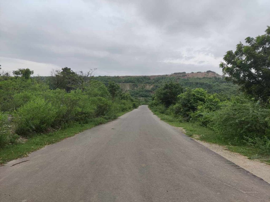
Just a narrow road cutting through greenery.
Golleti to Ullipitta Waterfall Was My Favourite Road
The stretch from Golleti towards Ullipitta Waterfall was easily one of the most scenic parts of the entire journey.
The distance was roughly 35 km on the route I followed.
The road becomes mostly a single-road village section.
Greenery surrounded both sides.
I could see small ponds and water bodies along the route.
After the rainfall, everything looked even better.
This part of the ride made me feel that choosing Ullipitta was already worth it.
Even if the waterfall turned out to be average, at least the road itself was giving me something memorable.
And there was another thing that made this route unusual.
Riding Through Telangana’s Coal-Mining Belt
A large portion of this region is associated with coal-mining activity.
While riding through the area, you start seeing the landscape change from peaceful village scenery to huge mining zones.
Coal projects around the Ullipitta Dorli and nearby Tiryani region have existed for years, including the Dorli open-cast mining areas. Historical documentation on the Dorli projects also identifies Ullipitta Dorli among villages affected by mining activity.
That combination made the route interesting.
One minute I was riding beside green ponds and forest areas.
A few kilometres later, huge mining landscapes appeared.
Later in the day, one of those mining viewpoints would actually become an unexpected stop on my trip.
But at this point I only had one destination in my head.
Ullipitta Waterfall.
Finally Reaching Ullipitta Waterfall
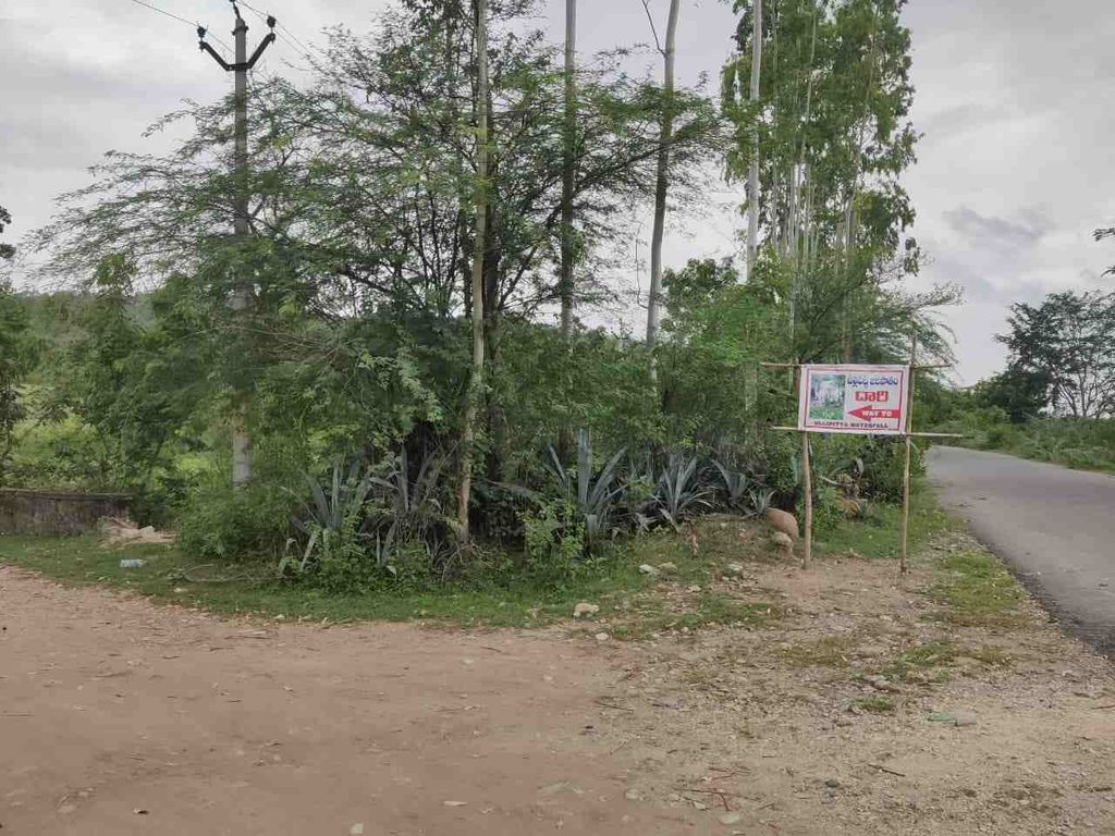
After approximately 45 minutes of riding from the Golleti side, I finally reached the Ullipitta Waterfall area.
The location was surprisingly easy to recognise.
There was a newly installed-looking Ullipitta Waterfall signboard/banner near the entrance.
I immediately felt excited.
After riding 151 km, getting soaked around Bellampalle and travelling through all those green village roads, I had finally reached the place I had watched on Instagram.
And something felt unusual.
There were no tourists.
No vehicles.
No crowd.
Nobody.
For a weekend tourist attraction, the place looked completely empty.
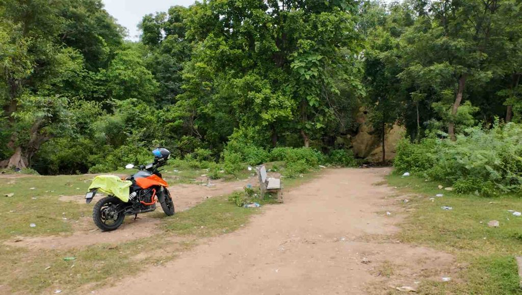
I parked my bike.
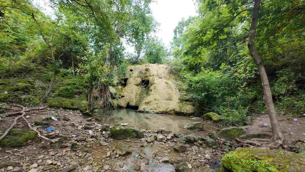
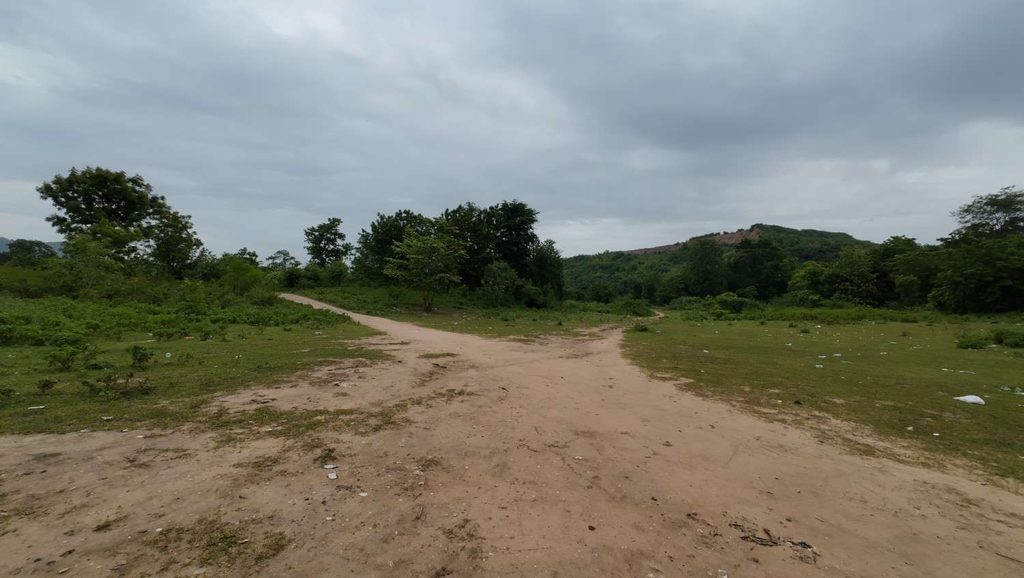
From the parking area itself, I could see the waterfall section.
And then I looked properly.
For a few seconds I just stood there.
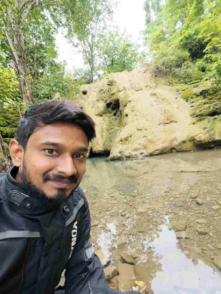
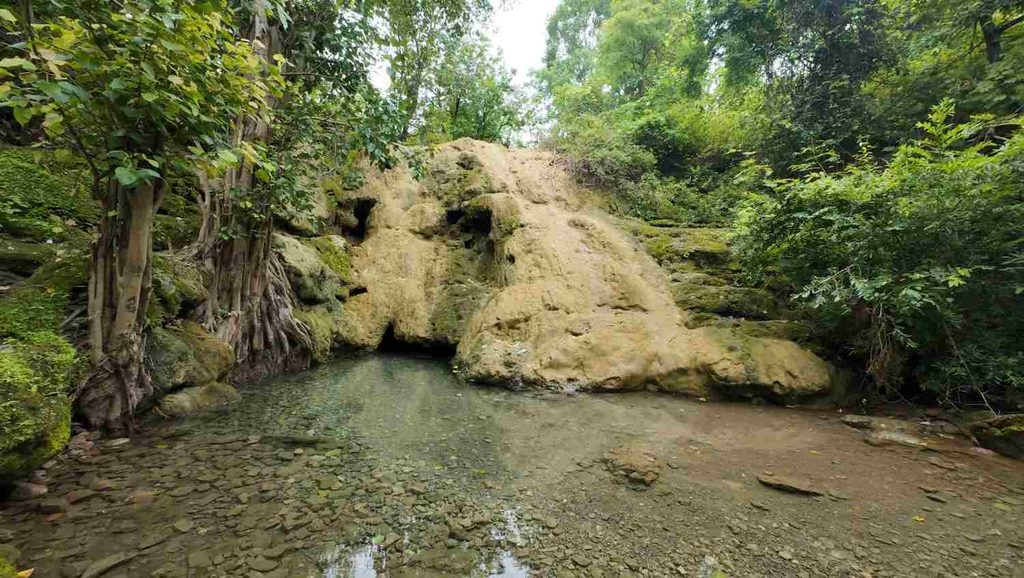
Because the waterfall I had travelled 151 km to see had almost no water flow at all.
After riding through such heavy rainfall near Bellampalle, this was the last thing I expected.
I had imagined a powerful monsoon waterfall.
Instead, I was looking at rocks.
That was the moment the trip started going in a very different direction.
And unfortunately, Ullipitta Waterfall having no water was not even the worst part of my day.
Ullipitta Waterfall: When the Trip Went Completely Wrong?
Standing in front of Ullipitta Waterfall after riding around 151 km from Karimnagar was honestly disappointing.
I had travelled through heavy rain near Bellampalle.
I had seen roads completely covered with rainwater.
The entire route after Golleti was green.
Small ponds were full.
The weather looked perfect for a waterfall trip.
So naturally, I expected Ullipitta Waterfall to have at least some decent water flow.
But there was almost nothing.
Ullipitta Waterfall Had No Water Flow During My Visit
The waterfall area was visible from the parking side itself.
I walked closer and looked around, hoping maybe I was seeing the wrong section.
No.
This was the place.
But the Ullipitta Waterfall had almost no water flow.
For a few minutes, I was genuinely sad.
I had seen the waterfall on Instagram, planned the entire weekend around it and ridden for more than three hours to reach here.
You cannot judge the waterfall condition based only on rainfall in another nearby town.
It had rained heavily near Bellampalle during my ride, but that did not mean Ullipitta’s catchment area had received enough rainfall to create proper flow.
That was my first lesson from the day.
My advice before visiting Ullipitta Waterfall
If you are planning a trip mainly to see strong waterfall flow, try to:
- Visit after several days of continuous rainfall
- Search Instagram or YouTube posts uploaded in the last few days
- Ask local people about current water flow
- Avoid assuming that one day of rain is enough
- Keep another nearby attraction as a backup
Waterfalls are unpredictable.
And Instagram Reels do not come with a live water-flow warning.
At Least I Took Some Ullipitta Waterfall Photos
Since I had already travelled so far, I did not want to simply turn around and leave immediately.
I parked my bike and started taking some photos.
Even without the waterfall flow, the surroundings were peaceful.
There was nobody else around during my visit, so I had the entire place almost to myself.
I took some photos with the rocky waterfall area in the background.
Of course, these were not the Ullipitta Waterfall photos I had imagined before starting the trip.
I wanted a large stream of water behind me.
Instead, I got a dry-looking waterfall.
Still, that is also part of travelling.
Not every destination gives you the perfect Instagram photo.
Sometimes the imperfect trip becomes the better story.
Ullipitta Waterfall Entry Fee and Parking Charges
One good thing about visiting Ullipitta Waterfall during my trip was that there were no charges.
During my visit:
- Ullipitta Waterfall entry fee: ₹0
- Parking charge: ₹0
I did not find anyone collecting tickets or parking fees.
There was also no ticket counter operating when I visited.
However, I noticed that the waterfall signboard looked quite new.
That made me think the local village or authorities may be starting to develop or promote the location.
So I would not assume that Ullipitta Waterfall will remain free forever.
If tourism increases, an entry or parking fee could be introduced in the future.
Therefore, consider ₹0 as my personal experience during my visit, not a permanent official price.
One Thing I Really Did Not Like at Ullipitta Waterfall
The lack of water flow disappointed me.
But something else disappointed me even more.
The trash.
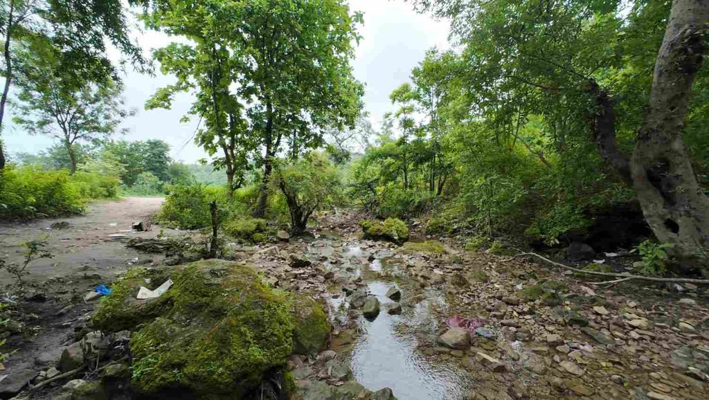
There were beer bottles and other waste lying around the waterfall area.
For such a quiet natural place, seeing this was frustrating.
If we are travelling to remote waterfalls because we love nature, then leaving bottles and plastic there makes absolutely no sense.
These places usually do not have full-time cleaning staff like city tourist attractions.
Whatever tourists leave behind can remain there for a long time.
So please follow one simple rule:
Whatever you carry to the waterfall, carry it back with you.
Sitting at Ullipitta and Accepting the Failed Plan
There were benches near the area.
I sat there for some time and looked around.
At that point, I had two choices.
I could keep feeling disappointed about the waterfall.
Or I could accept that the destination did not work out and enjoy whatever was left of the day.
I had already enjoyed the rain ride.
The road from Golleti had been beautiful.
I had seen a side of Telangana I had never explored before.
So after spending around 30 minutes at Ullipitta Waterfall, I decided to leave.
I thought the difficult part of the trip was over.
It was not.
The real trouble had not even started yet.
Leaving Ullipitta Waterfall
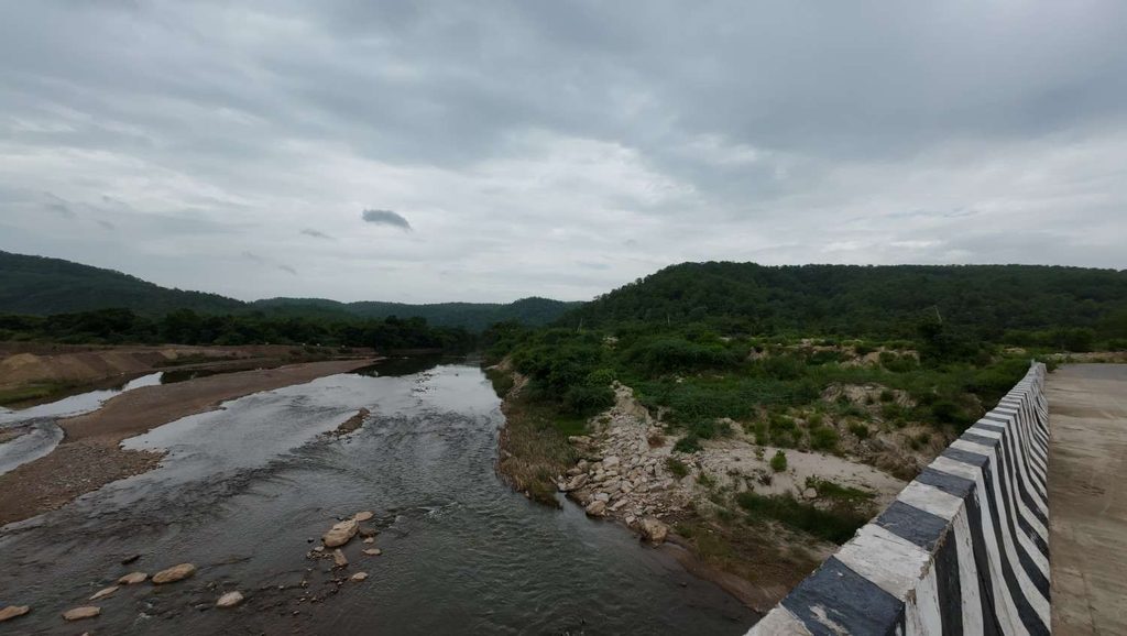
After leaving the waterfall, I stopped near a bridge on the route.
The surroundings looked good, so I parked my bike and clicked a few more photos.
One thing I like about bike trips is that sometimes the random stops between two destinations become more memorable than the actual tourist place.
After finishing the photos, I continued towards Khairigura View Point.
Khairigura View Point Felt Like a KGF Movie Scene
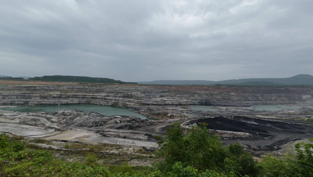
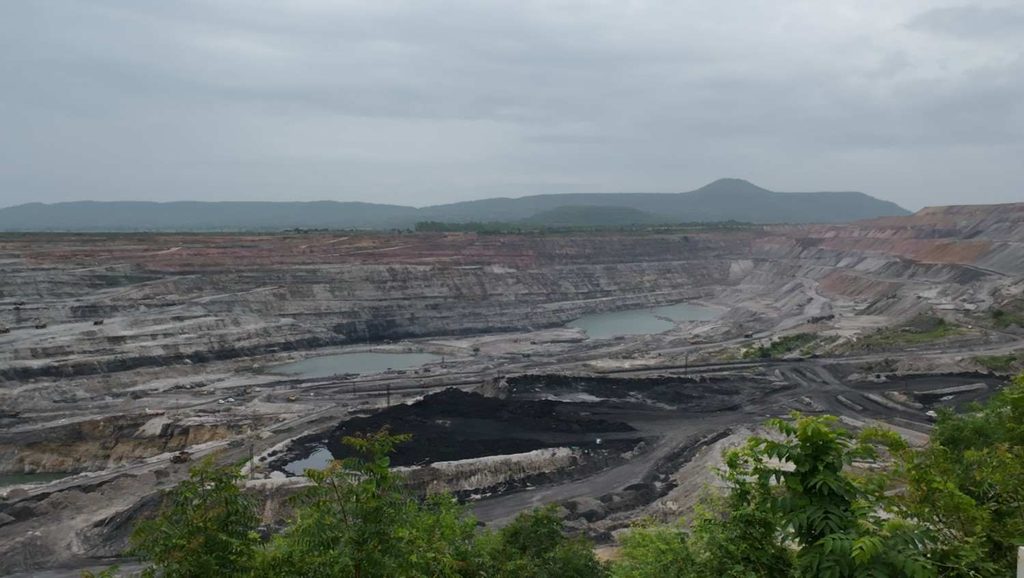
Khairigura is surrounded by mining activity.
When I reached the viewpoint area and looked at the massive mining landscape, the first thing that came into my mind was the movie KGF.
The scale of the mining area looked completely different from the green roads I had just ridden through.
Huge open sections of earth, mining activity and the industrial landscape made it feel like a movie set.
So naturally, I stopped for a few photos.
For me, this became an unexpected attraction during the Ullipitta trip.
I had originally travelled there only for the waterfall, but the mining landscape gave the day something different.
Asking a Security Guard for Nearby Places
At Khairigura View Point, I spoke with a security guard.
I asked him:
“Is there any other place nearby that I can visit?”
He suggested Thiryani Waterfall.
That would normally have been a good option.
But I had already visited Thiryani Waterfall on one of my previous trips.
So I told him I had already covered it.
I thanked him and started searching Google Maps for another nearby place.
That search would eventually cause the worst part of my entire day.
Finding Gandhari-Bokkalagutta Waterfall on Google Maps
While searching Maps, I found another location called Gandhari-Bokkalagutta Waterfall.
Immediately I got excited again.
My first waterfall had failed.
Maybe this one could save the trip.
According to Maps, it was roughly 60 km from Ullipitta Waterfall, and the direction was also useful because it was taking me towards my home route.
That sounded perfect.
Instead of returning disappointed, I could visit one more waterfall and make the day worthwhile.
So I decided to go.
Looking back now, this was the decision that completely changed the trip.
₹20 Tea Break Before Starting Again
Before connecting back towards the main road, I stopped for tea.
Until then, I had not eaten anything properly since morning.
I bought a cup of tea for ₹20.
I sat there for around ten minutes, rested a little and then started again.
This was also one of my biggest mistakes.
For a long motorcycle trip, especially when you are going into remote village areas, one cup of tea is not enough.
I should have:
- Eaten something
- Carried drinking water
- Bought at least two water bottles
- Checked the road conditions with locals
- Confirmed whether Gandhari-Bokkalagutta Waterfall was actually accessible
Instead, I did none of these things.
At the time, the waterfall was only another location pin on Google Maps.
And I trusted it.
Petrol Refill Before Gandhari-Bokkalagutta Waterfall
Before continuing further, I stopped at a petrol bunk.
I filled approximately 8 litres of petrol for ₹937.
After refuelling, I started following Google Maps towards Gandhari-Bokkalagutta Waterfall.
Initially, everything looked normal.
The map showed a route.
The distance was reducing.
So I continued.
Then I reached the area near Andgulapet.
And the road basically disappeared into water.
Google Maps Took Me to a River Crossing
The route shown by Google Maps was technically continuing ahead.
But there was one small problem.
A river was flowing across the road.
The route was correct on the map.
Physically, however, I could not continue normally with my bike.
There was water covering the crossing.
I stopped there and started thinking.
The destination appeared to be only around 2 km away.
And then my brain made one of those decisions that sounds completely reasonable for about thirty seconds.
“Only 2 km. I can walk.”
That was the beginning of my worst decision of the trip.
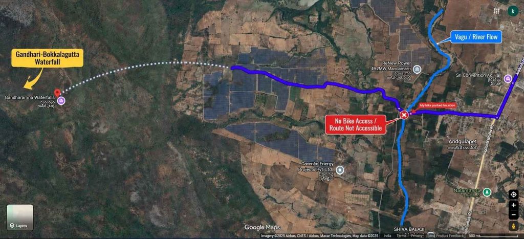
I Parked My Bike and Decided to Walk 2 KM
I parked my bike and crossed the water section on foot.
At that time, I completely underestimated what 2 km feels like when:
- You are wearing full motorcycle riding gear
- The weather is humid
- The road is muddy
- You have already ridden for hours
- You have not eaten properly
- You are carrying no water
- You have no idea what the actual route looks like
On Google Maps, 2 km looks tiny.
On foot under the wrong conditions, it feels very different.
Still, I started walking.
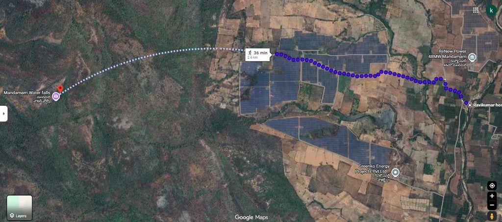
After 1 KM, I Was Already Exhausted
After roughly one kilometre, I was tired.
Very tired.
I started feeling thirsty.
And then I realised something stupid.
I had not carried a single bottle of water.
Since morning, I had basically survived on that ₹20 tea.
Now I was walking through a remote muddy route in full riding gear.
My body was getting hotter with every step.
At some points, I could literally feel heat building inside my riding jacket.
The humidity made everything worse.
That was when I met an older man driving a tractor.
I stopped him and asked:
“How far is Gandhari-Bokkalagutta Waterfall from here?”
He pointed towards a mountain in the distance.
That was when I started questioning the whole plan.
I had already walked about one kilometre.
I was tired.
I was thirsty.
The route did not look simple.
Part of me wanted to immediately turn back.
But another part of my brain said:
“You already walked 1 km. Only another 1 km is remaining.”
That was mistake number two.
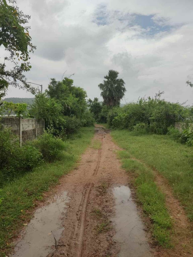
My Overconfidence Made Me Continue
I continued walking.
The route became muddy and slippery in some sections.
Walking with riding shoes and full gear was difficult.
There was no proper tourist trail.
No waterfall signboard.
No direction board.
Nothing telling me whether I was even approaching the correct place.
Still, I trusted the map.
Step by step, I completed what Google Maps showed as the remaining distance.
Finally, I reached the location pin.
And there was no waterfall.
Again.
At that point, I could not believe what was happening.
Security Guard Gave Me the Bad News
Near the location shown on Google Maps, there was a large solar installation.
A security guard was present there.
I approached him and asked:
“Where is Gandhari-Bokkalagutta Waterfall?”
His answer nearly finished whatever energy I had left.
He told me:
“From here, you still have to go around 3 km.”
For a few seconds, my brain genuinely stopped processing the information.
I had already parked my bike.
Crossed the river.
Walked roughly 2 km.
Reached the exact location shown by Google Maps.
And now I was being told that the actual waterfall was still another 3 km away.
That meant walking further into an unfamiliar remote area.
Alone.
Without water.
With no proper route knowledge.
Thankfully, the security guard gave me the advice I should have given myself much earlier.
He told me:
If you are alone, don’t go. Come again with friends.
This time, I listened.
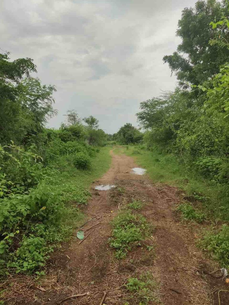
Asking the Security Guard for Water
By then, I was extremely thirsty.
I asked the security guard if he had any drinking water.
He gave me some.
That water felt more valuable than anything else on the entire trip.
After drinking, I thanked him and decided to return.
No Gandhari-Bokkalagutta Waterfall.
No second chance.
Another failed destination.
But at that point, I no longer cared about seeing the waterfall.
I just wanted to reach my bike.
Return Walk Felt Much Longer
Going towards the waterfall had been difficult.
Walking back felt worse.
When you are excited about reaching a destination, your mind keeps pushing you forward.
On the return, there was nothing to look forward to except reaching the parked bike.
My body was tired.
My riding gear felt heavier.
The heat felt worse.
And the only thought going through my mind was:
“When will I reach my bike?”
Eventually, after around 45 minutes, I finally saw the place where I had parked it.
That was probably the happiest moment of the entire failed waterfall attempt.
Locals Confirmed This Was an Access Route
Near my parked bike, a few local people were sitting and drinking beer.
I asked them whether this was the only route towards Gandhari-Bokkalagutta Waterfall.
They said this route was used.
I had also seen local people carrying motorcycles through the area for access to agricultural fields, and even the solar security staff were reaching their work area on two-wheelers.
So there may be local ways of crossing or navigating the route.
But for an outsider visiting alone, the situation was completely different.
Without local knowledge, I would not recommend blindly following the same Google Maps route I used.
If you plan to visit Gandhari-Bokkalagutta Waterfall:
- Ask local villagers before taking the final approach
- Confirm whether the road is passable
- Ask which route is safest
- Avoid going alone
- Carry plenty of drinking water
- Wear proper trekking footwear
- Do not assume Google Maps’ destination pin is the actual waterfall
- Avoid river crossings during strong monsoon flow
- Do not attempt an unknown route just because Maps shows a short remaining distance
I will also pin the problem location in my article so travellers can understand where I faced the blocked route.
Why This Area Needs a Direction Board?
My biggest suggestion to the local administration or nearby villages is simple.
Please install a proper direction board.
Even a basic sign saying:
Gandhari-Bokkalagutta Waterfall – No Vehicle Access From This Route
or
Waterfall Route – Ask Locals Before Proceeding
would help travellers enormously.
Google Maps is useful, but in remote areas, it cannot always tell you:
A small board could save someone from making exactly the same mistake I made.
Finally Starting My Bike Again
The moment I reached the bike, I did not want to stand there any longer.
It was extremely hot.
There was hardly any breeze.
I started my bike and left as quickly as possible.
Once the bike started moving, finally some air started flowing through my riding gear.
That itself felt like relief.
By then, the idea of visiting another tourist attraction was completely gone.
I only wanted one thing.
Home.
One of the Worst Trips I Have Experienced
The return journey gave me a lot of time to think.
The day had started with excitement.
I had discovered Ullipitta Waterfall through Instagram.
Prepared my motorcycle.
Started at 6 AM.
Enjoyed the rain.
Rode through beautiful green roads.
Then everything went downhill.
First, Ullipitta Waterfall had no flow.
Then I trusted another location on Google Maps.
Then I parked my bike.
Crossed water.
Walked kilometres in riding gear.
Ran out of energy.
Had no drinking water.
Reached the wrong location.
And finally returned without seeing the second waterfall either.
In terms of destinations, the trip was a complete failure.
But in terms of lessons, this trip probably taught me more than many successful rides.
Biggest Lessons I Learned From This Trip
1. Never blindly trust Google Maps in remote areas
Google Maps can bring you close to a place.
That does not mean the last kilometre is actually accessible.
Always verify with locals.
2. Never underestimate a 2 KM walk
Two kilometres on a city road and two kilometres through muddy village terrain are completely different things.
Especially when wearing riding gear.
3. Always carry water
This was probably my biggest mistake.
Even if you are planning only a road trip, carry at least one or two bottles.
Plans change.
Vehicles get stuck.
Routes close.
You may suddenly have to walk.
4. Eat before exploring remote locations
Tea is not breakfast.
I learned that very clearly on this trip.
5. Solo travel needs an exit plan
I love travelling solo.
But solo travel also means knowing when to stop.
When the security guard told me not to continue alone, turning back was the correct decision.
6. A failed destination does not always mean a failed trip
I did not see either waterfall properly.
But I still experienced:
- Heavy monsoon riding
- Beautiful roads after Bellampalle
- Green village landscapes
- Coal-mining scenery
- Khairigura View Point
- Remote Telangana roads
- A travel lesson I will probably never forget
Sometimes the story comes from everything that goes wrong.
Finally Reaching Home
After starting the return journey, it took me around 2 hours 30 minutes to reach home.
By the time I arrived, I had almost no energy left.
Normally after a bike ride, I freshen up first.
Not this time.
I was so hungry and tired that I started eating lunch immediately.
After finishing my food, I went straight to sleep.
No photo sorting.
No trip review.
No Instagram.
Nothing.
My body was done for the day.
And that was how a simple Saturday ride to Ullipitta Waterfall became one of the most difficult trips I have experienced.
Would I call the entire journey useless?
No.
Would I repeat the same mistakes?
Absolutely not.
And if you are planning to visit Ullipitta Waterfall or Gandhari-Bokkalagutta Waterfall, hopefully my mistakes can save you from making the same ones.
Ullipitta Waterfall Complete Travel Guide
After everything that happened during my trip, I think Ullipitta Waterfall is one of those places where a little preparation can completely change your experience.
The waterfall itself is seasonal. During my visit, there was almost no water flow even though I had experienced heavy rainfall near Bellampalle on the way. (Visited in Mid of August)
That taught me an important lesson.
Do not plan a trip to Ullipitta Waterfall only because it rained somewhere nearby. Check the recent water flow before travelling.
The surrounding roads, greenery, village landscapes and mining belt made my 151 km ride from Karimnagar enjoyable, but if your only purpose is to see a powerful waterfall, timing your visit correctly is very important.
Here is everything I learned from my trip.
Is Ullipitta Waterfall in Adilabad?
You may find some websites or social media posts referring to Ullipitta Waterfall as being in Adilabad.
This can be confusing.
For current travel planning, Ullipitta should be considered part of the Kumuram Bheem Asifabad district region of Telangana, rather than present-day Adilabad district.
The Kumuram Bheem Asifabad district administration currently lists Tiryani among its mandals.
If you are creating your Google Maps route, search specifically for Ullipitta Waterfall instead of simply searching for waterfalls in Adilabad.
Ullipitta Waterfall Distance From Major Cities
| Starting Place | Approx. Distance to Ullipitta Waterfall | Approx. Travel Time | Suggested Route |
| Karimnagar | 151 km | 3.5–4 hours | Karimnagar → Peddapalli → Ramagundam → Bellampalle → Tandur → Golleti → Ullipitta |
| Hyderabad | Around 300–320 km | 6–7 hours | Hyderabad → Siddipet → Karimnagar/Peddapalli → Ramagundam → Bellampalle → Ullipitta |
| Warangal | Around 230–250 km | 5–6 hours | Warangal → Peddapalli/Ramagundam → Bellampalle → Tandur → Ullipitta |
| Bellampalle | Around 20–30 km | 45 min–1 hour | Bellampalle → Tandur/Golleti side → Ullipitta |
| Thiryani Waterfalls | Around 15–20 km | 30–45 minutes | Local Tiryani forest/village route |
Karimnagar to Ullipitta Waterfall Distance
From my home in Karimnagar, my route to Ullipitta Waterfall was approximately:
151 km
It took me close to:
3 hours 30 minutes
This can change depending on:
- Traffic
- Rain
- Road diversions
- Your starting point in Karimnagar
- Breaks
- Village-road conditions
Because I faced heavy rain near Bellampalle, my journey also became slower in that section.
My Karimnagar to Ullipitta Waterfall Route
I followed this route:
Karimnagar → Peddapalli → Ramagundam → Bellampalle → Tandur → Golleti → Sonapur side → Ullipitta Waterfall
For me, this route worked well.
The main roads from Karimnagar towards Tandur were in good condition during my ride.
The most scenic section started after leaving the major roads.
Hyderabad to Ullipitta Waterfall
If you are travelling from Hyderabad, this is a relatively long road trip and is better planned as a full-day or overnight journey rather than a casual half-day visit.
A practical route from Hyderabad can be planned towards:
Hyderabad → Siddipet → Karimnagar/Peddapalli → Ramagundam → Bellampalle → Tandur → Ullipitta
Organised waterfall trips from Hyderabad into this part of the Asifabad region also commonly use the Hyderabad–Siddipet–Karimnagar–Peddapalli corridor.
Because the exact distance changes depending on your chosen approach road and starting point in Hyderabad, check Google Maps on the day of travel rather than relying on one fixed kilometre figure.
If travelling from Hyderabad, I would personally recommend starting around 4:30 AM to 5:00 AM.
That gives you more daylight to handle the final village roads safely.
How to Reach Ullipitta Waterfall?
By Bike
For me, a bike was the best way to visit Ullipitta Waterfall.
The main roads were good during my trip, and the final section gave me exactly the kind of quiet countryside riding I enjoy.
However, during monsoon:
- Wear proper riding gear
- Keep rain gear easily accessible
- Reduce speed during heavy rain
- Maintain extra braking distance
- Avoid deep water crossings
- Do not ride through flooded roads if you cannot judge the depth
The rainfall near Bellampalle became so heavy during my trip that I had to stop beside the highway because I could barely see through my helmet visor.
Never force yourself to maintain highway speed in such conditions.
By Car
A car should also be practical for reaching the general waterfall area.
In fact, a car may be more comfortable if you are travelling with family, especially during rainy weather.
However, village roads can change quickly during monsoon, so verify the final approach before travelling.
Ullipitta Waterfall Timings
I could not find official Ullipitta Waterfall timings published by the Telangana Tourism Department or district administration.
So I would not confidently claim that Ullipitta Waterfall is officially open 24 hours.
Some online listings may display all-day access, but a remote waterfall being physically accessible does not mean visiting after dark is sensible.
Recommended Ullipitta Waterfall timing
7:00 AM to 5:00 PM
This is my recommended travel window, not an official government timing.
Try to leave the area well before sunset.
The region has remote village and forest roads, and there is little benefit in reaching a seasonal waterfall after dark.
Ullipitta Waterfall Entry Fee
During my visit:
Entry fee: ₹0
Nobody was collecting a ticket.
There was no active ticket counter when I visited.
However, this may change in the future.
The signboard at the waterfall looked relatively new during my visit, so it appeared that the place may gradually be getting more recognition.
If visitor numbers increase, local authorities or village committees could potentially introduce maintenance or entry charges later.
Therefore:
₹0 was the fee during my visit. Check locally for the latest fee before travelling.
Ullipitta Waterfall Parking Charges
Parking was also completely free during my trip.
Parking fee during my visit: ₹0
I could park my bike close to the waterfall area.
Because there was nobody else at the destination when I reached, parking was not a problem at all.
This might be different on a busy Sunday during good waterfall flow.
Best Time to Visit Ullipitta Waterfall
This is probably the most important section of this entire guide.
Best season: Monsoon
The wider Asifabad waterfall belt is strongly seasonal. Regional waterfall guides generally identify the monsoon as the prime period, while reports on waterfalls in Tiryani specifically describe strong flow during the rainy months.
A general planning window would be:
July to September or early October
But do not use the month alone to decide.
Check rainfall before visiting
The better question is not:
“Is August a good month?”
It is:
“Has the Ullipitta/Tiryani area received enough rain recently?”
That distinction matters.
I travelled through extremely heavy rainfall around Bellampalle and naturally thought Ullipitta would have good water flow.
When I reached there, the waterfall was practically dry.
Even organised waterfall groups visiting Ullipitta and Thiryani note that their itinerary may change depending on rainfall and recent water flow.
Is Ullipitta Waterfall Open Throughout the Year?
The location may remain physically accessible at different times of the year, but Ullipitta is a seasonal waterfall.
That means visiting in summer or after a long dry spell could result in little or no waterfall.
A current Telangana waterfall directory also classifies Ullipitta among the forest waterfalls of the Asifabad region and recommends monsoon travel for waterfalls across the district.
If your main goal is photography or seeing strong flow, I would not recommend visiting during the dry season.
How Much Time Do You Need at Ullipitta Waterfall?
For most visitors:
30 minutes to 1 hour should be enough.
I personally spent around 30 minutes there.
If water flow is strong and you are travelling with friends, you may naturally stay longer.
But Ullipitta is not currently the kind of developed tourist attraction where you need half a day for facilities, activities or sightseeing.
For me, the road trip was a bigger part of the experience than the actual waterfall.
Facilities at Ullipitta Waterfall
Do not travel to Ullipitta expecting the infrastructure of a famous tourist destination.
During my visit, I would describe it as a basic nature spot rather than a developed tourism complex.
I recommend assuming that you may not reliably find:
- Restaurants
- Drinking water
- Toilets
- Changing rooms
- Fuel
- Medical assistance
- Reliable mobile connectivity
If something is available during your visit, consider it a bonus.
Prepare as if nothing is available.
That would have saved me a lot of trouble later in the day.
Nearby Places to Visit Around Ullipitta Waterfall
If Ullipitta has poor water flow, having a backup destination is a smart idea.
1. Thiryani Waterfall
Thiryani Waterfall would be my first alternative because it is in the same general waterfall belt.
In fact, when I asked a security guard near Khairigura about another attraction, Thiryani Waterfall was the place he suggested.
I had already visited it, so I did not go there again.
The Tiryani forests are known for multiple seasonal waterfalls.
If you are visiting the region for the first time, combining Ullipitta Waterfall + Thiryani Waterfall can make more sense than travelling such a long distance for Ullipitta alone
2. Khairigura Mining Area/View
I stopped around the Khairigura mining area during my return journey.
The massive open mining landscape immediately reminded me of scenes from KGF.
It looked completely different from the green forest roads nearby.
However, remember that this is an active industrial/mining region, not a normal sightseeing park.
Do not enter restricted mining zones.
Follow security instructions and take photographs only where stopping is legally and safely permitted.
3. Mitta/Saptagundala Waterfalls
Another important waterfall destination in Kumuram Bheem Asifabad district is Mitta Waterfalls, also known as Saptagundala Waterfalls.
The district administration describes Saptagundala as a group of seven waterfalls surrounded by hills and forest. It also warns that reaching the area involves rough terrain and a trek because proper road access is limited.
Do not casually add this after Ullipitta unless you have researched the route and have enough time.
| Nearby Place | Approx. Distance From Ullipitta | Why Visit |
| Thiryani Waterfalls | 15–20 km | Best nearby waterfall option |
| Bellampalle | 20–30 km | Food, fuel and major-town facilities |
| Golleti | Around 35 km | Scenic road and mining-region landscape |
| Khairigura Mining Area | Nearby route | Interesting mining landscape; view only from permitted areas |
| Gandhari-Bokkalagutta Waterfall | Around 60 km | Remote waterfall, but confirm access with locals first |
What About Gandhari-Bokkalagutta Waterfall?
After leaving Ullipitta, I found Gandhari-Bokkalagutta Waterfall on Google Maps.
It looked like the perfect second destination because it was around 60 km from Ullipitta on the route I was following towards home.
Instead, it became the hardest part of my trip.
Google Maps took me towards Andgulapet, where a small river had covered the road.
I parked my bike because Maps showed the destination only around 2 km away.
I walked.
After reaching the location shown on Maps, a solar-plant security guard told me that the actual waterfall was still roughly another 3 km away.
Because I was travelling alone, he advised me not to continue.
I listened to him and returned.
My recommendation for Gandhari-Bokkalagutta
Do not follow my route blindly.
Before visiting:
- Ask local villagers for the correct entrance
- Confirm road conditions
- Confirm whether river crossings are safe
- Take a local guide if necessary
- Visit with friends rather than alone
- Carry enough water
- Do not rely only on the Google Maps pin
There may be another better approach route.
Please confirm it locally before travelling.
Is Ullipitta Waterfall Safe?
I did not personally face any dangerous situation at the waterfall itself during my visit.
However, remote waterfalls require more personal responsibility than developed tourist attractions.
My Ullipitta Waterfall Trip Cost
These are expenses I specifically recorded during the trip.
| Expense | Cost |
| Ullipitta Waterfall entry | ₹0 |
| Parking | ₹0 |
| Tea | ₹20 |
| Petrol refill | ₹937 |
| Petrol quantity | Around 8 litres |
| Known cash spending | ₹957 |
One important clarification:
The ₹937 petrol refill should not automatically be treated as the exact fuel consumed only for this trip, because some petrol remained in the bike afterwards.
It is simply the amount I paid at the petrol bunk during the journey.
I did not spend money on a waterfall ticket or parking during my visit.
Can You Visit Ullipitta Waterfall With Family?
Yes, you can consider Ullipitta as a family road-trip destination when the weather, road and waterfall conditions are good.
However, it is better suited to travellers who are comfortable visiting less-developed nature spots.
I would research current facilities before travelling.
If you want a highly developed tourist attraction with guaranteed facilities, Ullipitta may not be the best choice.
Is Ullipitta Waterfall Worth Visiting?
This depends entirely on what you expect.
If you ask me:
“Would you travel 151 km only to see Ullipitta Waterfall with no water?”
No.
But if you ask:
“Was the entire ride wasted?”
Also no.
The journey gave me:
- A proper 300+ km riding day
- Heavy monsoon riding near Bellampalle
- Beautiful green roads
- Quiet village scenery
- Coal-mining landscapes
- Khairigura views
- A completely unexpected adventure
- Several lessons about solo travel
My biggest recommendation is simple:
Visit Ullipitta when recent water flow is confirmed.
If there is good flow, the waterfall can become the main attraction.
If there is no flow, you are mostly travelling for the road and surrounding nature.
My Final Verdict on Ullipitta Waterfall
I started this trip because of a random Instagram Reel.
Like always, I researched the location, prepared my bike on Friday and started early on Saturday morning.
I expected a relaxing waterfall ride.
Instead, I got heavy rain, a dry waterfall, mining landscapes, a wrong Google Maps route, a river crossing, kilometres of walking, dehydration and two unsuccessful waterfall attempts.
By the time I reached home, I did not even have enough energy to freshen up before eating.
I ate my lunch and went directly to sleep.
At that moment, I probably would have called it one of my worst trips.
Now, when I think about it, I see it differently.
Good trips give you memories.
Bad trips give you lessons.
This one gave me both.
The biggest lesson was:
Never underestimate a destination just because Google Maps shows only 2 km remaining.
And never enter a remote route without water.
If you are planning Ullipitta Waterfall, check the latest water flow, start early, carry your essentials and keep a backup destination.
The waterfall may or may not cooperate.
But the road to Ullipitta can still give you a beautiful Telangana monsoon ride.
My One-Line Recommendation
Visit Ullipitta Waterfall after confirmed monsoon rainfall, start early, carry your own water and food, and never blindly trust the final Google Maps route when exploring remote waterfalls in this region.
My Overall Review
⭐⭐⭐⭐⭐ 3.5/5
- Scenic Beauty: ⭐⭐⭐
- Road Trip Experience: ⭐⭐⭐⭐
- Photography: ⭐⭐⭐
- Peace & Serenity: ⭐⭐⭐⭐
- Value for a Weekend Trip: ⭐⭐⭐⭐
Frequently Asked Questions
What is the distance from Karimnagar to Ullipitta Waterfall?
The route I travelled from Karimnagar to Ullipitta Waterfall was approximately 151 km and took me around 3 hours 30 minutes.
What are Ullipitta Waterfall timings?
I could not verify an official government opening and closing time for Ullipitta Waterfall. I recommend visiting only during daylight, preferably between 7:00 AM and 5:00 PM.
What is the best time to visit Ullipitta Waterfall?
The best time is during the monsoon after consistent rainfall, generally around July to September or early October. Check recent photos and local rainfall before travelling because Ullipitta is seasonal.
Is Ullipitta Waterfall good for a one-day trip?
Yes, especially from Karimnagar, Bellampalle and nearby towns. From Hyderabad, I would plan a much earlier start or consider combining the area with an overnight trip.
Is Ullipitta Waterfall worth visiting?
Yes, if the waterfall has good water flow or you enjoy scenic road trips. If you are travelling only for the waterfall, verify recent flow before covering a long distance.
Is Ullipitta Waterfall crowded?
During my Saturday visit, nobody else was there. Crowd levels can be very different on Sundays and during peak monsoon weekends.

Solo traveller, biker, and explorer sharing honest travel guides, hidden places, and unforgettable road trips across India.