
Visapur Fort Trek: My Solo Birthday Adventure
Some birthdays are celebrated with cake, parties, and friends.
I decided to celebrate mine by waking up at 2 AM, catching a local train from Pune, walking several kilometres without Google Maps, getting lost on a mountain, and finally reaching the top of Visapur Fort alone.
Looking back now, it sounds a little crazy.
But this Visapur Fort trek became one of those trips that changed the way I looked at solo travel.
After completing my Bachelor of Engineering, I was in a phase where I wanted some time for myself. After years of education, assignments, exams, and thinking about what to do next in life, travelling around Maharashtra gave me the mental break I badly needed.
My first proper solo trekking experience was Devkund Waterfall. Completing that trip successfully gave me a completely different level of confidence.
Before Devkund, there was always that small fear in my mind:
Can I actually travel alone?
After Devkund, the question changed to:
Where should I go next?
That is how Visapur Fort entered my travel list.
Visapur Fort Quick Information
Before getting into my journey, here is some basic information that will help if you are planning the trek yourself.
| Information | Details |
| Place | Visapur Fort |
| Location | Near Malavli/Lonavala, Pune District, Maharashtra |
| Type | Hill fort |
| Visapur Fort height | Around 1,084 metres / 1.084 km / 3,556 ft above sea level |
| Trek difficulty | Moderate for most trekkers & Very difficulty for beginners |
| Beginner friendly? | Yes, if you use the popular route and have reasonable fitness |
| Popular base villages | Bhaje/Bhaja, Lohagadwadi side and Patan |
| Visapur Fort distance from Pune | Around 60–65 km by road, depending on starting point |
| Nearest railway station | Malavli |
| Trek duration | Roughly 1.5–3 hours to ascend, depending on route and fitness |
| Best season | Monsoon and post-monsoon are especially popular |
| Main attractions | Fort walls, ruins, water cisterns, plateau views and monsoon trail |
| Nearby attractions | Lohagad Fort, Bhaja Caves, Karla Caves, Pawna Lake, Lonavala |
One Important Thing About Trek Distances
If you search for Visapur Fort trek distance in km, you may find different numbers online.
That doesn’t necessarily mean somebody is wrong.
There are multiple approaches to the fort. Indiahikes lists approximately 8 km total for the Bhaje village route and around 6 km total for the Patan route, both calculated as round trips. (Indiahikes)
My own trek was from the Patan village side, but I did it years ago without an Android phone or GPS tracking. So I don’t want to give you a fake exact kilometre figure based only on memory.
That old-school travel experience is actually one of my favourite parts of this story.
Why I Chose Visapur Fort?
After my successful Devkund trip, I started searching for forts around Pune that were reasonably accessible using public transport.
At that time, I didn’t have my own bike in Pune, so accessibility mattered a lot.
I needed somewhere where I could:
- travel from Pune by train or public transport,
- complete the trek without expensive arrangements,
- explore the place in one day,
- and return using public transport.
During my research, I found Visapur Fort near Malavli.
The photos caught my attention first. The fort sits high above the surrounding green hills, with long stone walls, a huge plateau and views across the Sahyadri region.
And that settled it.
My next solo trek was going to be Visapur Fort.
Except there was one small detail.
I Planned the Trek on My Birthday
Yes.
Instead of spending my birthday in the hostel sleeping, scrolling through my phone and doing nothing special, I decided to climb a fort.
For me, that sounded much better than a normal birthday celebration.
The night before the trip, I prepared whatever I needed and tried to sleep early because I had to wake up at 2 AM.
Tried is the important word here.
I went to bed at around 10 PM, but sleep wasn’t coming easily.
My mind kept throwing questions at me.
Should I really go alone?
Will transport be available this early?
What if I miss the train?
What if I cannot find the trekking route?
This was only my second proper solo trek, so those doubts felt very real.
Then another thought came into my mind.
This is my birthday. Why waste the day sleeping in the hostel and spending hours on the phone?
That thought was enough.
Eventually, I slept.
2 AM Wake-Up for My Birthday Trek
My alarm went off at around 2 AM.
I freshened up, got ready and booked an Ola from BJS Phata, Wagholi, where I was staying at the time, to Pune Railway Station.
Because it was such an early hour, the cab cost me around ₹350.
That was a decent amount for me at that stage, especially because I was trying to complete trips as cheaply as possible.
But there wasn’t really another convenient option at that hour.
I reached Pune Railway Station at approximately 3:50 AM.
From there, I purchased a local train ticket to Malavli Railway Station.
My ticket cost only ₹15 at that time.
Please don’t use my old ticket price as the current fare. Railway fares and services can change, so check the latest ticket price when you travel.
That ₹15 ticket, however, was the beginning of one of my favourite birthday memories.
Pune to Malavli by Local Train
At the time of my trip, an early Pune-Lonavala local was available at around 4 AM, so I boarded the train towards Malavli.
When I entered the coach, almost nobody was there.
Empty local train.
Early morning darkness outside.
Music playing.
And one guy travelling alone to climb a fort on his birthday.
I still remember that feeling.
I found a seat, sat down and started listening to music.
For the first half hour everything went normally.
Then the train stopped.
And kept standing.
Apparently, another special train had to pass, so our local was halted at a junction for almost 30 minutes.
Today, thirty minutes doesn’t sound like much. You take out your smartphone, open YouTube, Instagram or something else and somehow the time disappears.
But I didn’t have a proper Android phone then.
I had a Nokia phone.
There wasn’t much internet access, and even the mobile network wasn’t helping.
So I simply sat there.
And waited.
And waited some more.
Those thirty minutes felt longer than parts of the trek.
Eventually the train started moving again.
After the delay and another stretch of travelling, I finally reached Malavli Railway Station at around 6 AM.
Reaching Malavli at 6 AM
Stepping onto Malavli station that morning felt like the real beginning of the trip.
I bought some tea, washed my face a little and started thinking about the next problem.
How exactly do I reach Visapur Fort from here?
Today this would be simple.
Open Google Maps.
Check the route.
Follow the blue line.
Back then, I didn’t have that luxury.
During my college days I didn’t own a proper smartphone that I could comfortably use for navigation. Every time I travelled somewhere unfamiliar, my navigation system was basically:
find a local person and ask.
Strangely, I now think that was one of the most interesting ways to travel.
You speak with people.
You remember landmarks.
You pay attention to roads.
You sometimes take the wrong direction.
And yes, sometimes you get completely lost.
I experienced all of that on this trip.
Asking Locals for the Visapur Fort Route
After coming out of Malavli Railway Station, I asked a local person how to reach Visapur Fort.
He explained that I needed to cross towards the Mumbai-Pune Expressway side and continue towards Patan village.
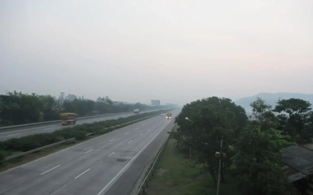
So I started walking.
Modern trekking guides still recognise Patan as one of the established routes to Visapur. However, it is the less commonly used and harder-to-follow trail, so I would not recommend blindly copying my solo route today simply because I managed to complete it. The better-marked Bhaje side is generally easier for first-time visitors. (Treks and Trails India)
This detail also explains what happened to me later.
I walked several kilometres from Malavli towards Patan. From my memory, I thought it was roughly 3–4 km, although current trekking references place parts of the Patan approach farther depending on where exactly you consider the trailhead. Because I didn’t record GPS data during my trip, I prefer treating my old distance as an estimate rather than an exact measurement.
Eventually, I met another local person and asked again:
“Visapur Fort cha rasta kuthun aahe?”
He pointed towards a path and told me to continue from there.
That became the beginning of my actual trek.
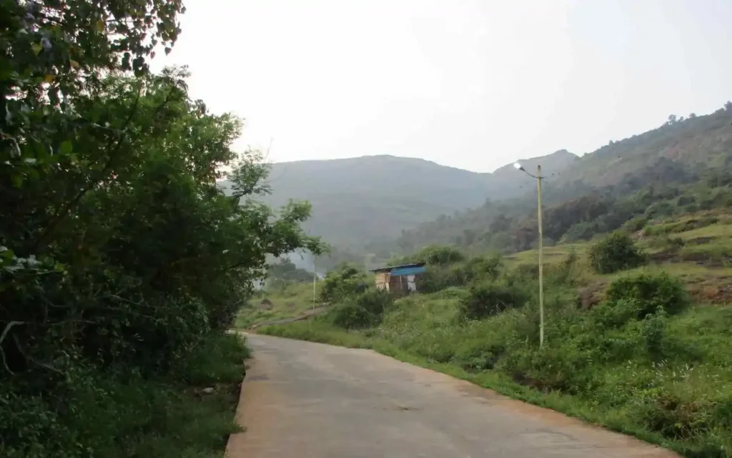
My Biggest Trekking Mistake: Jeans and Canvas Shoes
This part still makes me laugh.
Because it was my birthday, I wanted some nice Visapur Fort photos.
Instead of thinking like a trekker, I thought like someone going for birthday pictures.
So what did I wear?
Jeans, a T-shirt and canvas shoes.
Terrible combination.
I learned that lesson the hard way.
Jeans restricted my movement while climbing. Once I started sweating, the clothing became uncomfortable. And canvas shoes were definitely not what I would choose today for rocky or slippery trekking terrain.
Slowly, I kept climbing.
After this trip, one rule became very clear for me:
Dress for the trek first. Photos come second.
If you’re attempting the Visapur Fort trek, especially during or immediately after the monsoon, proper shoes with good grip are much more important than looking stylish.
The monsoon route can become slippery, and some approaches involve climbing over wet rocks or through flowing water. (Treks and Trails India)
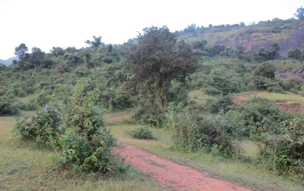
Then I Got Lost
Around thirty minutes into the trek, something went wrong.
I couldn’t understand where the actual path was anymore.
There were no people around me.
No Google Maps.
No proper phone navigation.
No experience with this particular fort.
And suddenly I realised:
I was lost.
That moment genuinely scared me.
Until then I had been excited about doing everything solo.
But being alone somewhere on a mountain where you don’t know the trail gives you a completely different feeling.
I stopped trying to guess the route and started reversing my path.
That turned out to be the correct decision.
Even today, this is one trekking rule I strongly believe in. If you genuinely don’t recognise the route, don’t keep moving forward simply because you don’t want to turn back.
After reversing for some distance, I suddenly heard voices.
I stopped.
Listened carefully.
There were people nearby.
So I followed the direction of the voices, went back towards the trail and finally spotted a small group of trekkers.
And yes, they were also heading towards Visapur Fort.
The amount of relief I felt at that moment is difficult to explain.
I wasn’t magically less tired.
My legs still hurt.
The climb was still there.
But mentally, I felt much better because at least I knew I was moving in the right direction.
I started following them from a distance.
How Difficult Did I Find the Visapur Fort Trek?
If someone asks me about the Visapur Fort trek difficulty level, my answer has two parts.
From a technical perspective, Visapur is generally considered a moderate trek, and the popular routes can even be suitable for beginners with decent fitness. Indiahikes notes that the Bhaje route does not normally involve technical climbing or highly exposed sections. (Indiahikes)
But my personal experience felt difficult.
There were several reasons:
I was still a beginner. It was only my second major solo trek. I had already walked from Malavli. I was wearing jeans and canvas shoes. I had accidentally taken a less straightforward route. And after getting lost, I was mentally tired too.
So halfway through the climb, my legs started hurting badly.
I became exhausted.
I slowed down.
Instead of trying to match other people’s speed, I took my time.
Step by step.
Break by break.
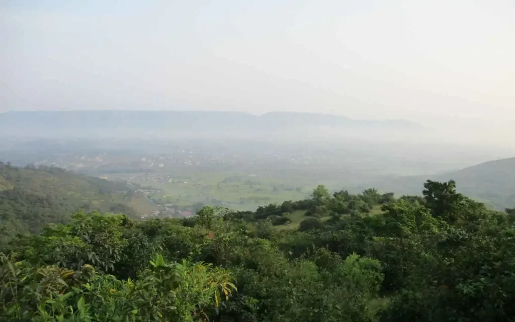
Eventually, after roughly 2.5 hours of trekking in my experience, I finally reached the top.
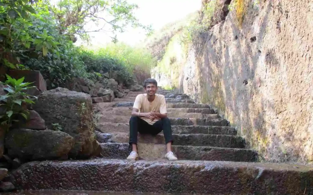
The image below shows the famous Instagram spot that looks best during the rainy season. When water flows over this path, the scenery becomes beautiful and highly photogenic.
Reaching the Top of Visapur Fort
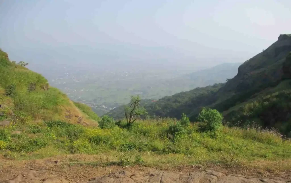
That first view from the top made the struggle worth it.
The plateau opened in front of me.
The hills stretched across the landscape.
The air felt completely different.
After walking for hours, losing the route, worrying about whether I would actually reach the fort and exhausting myself on the climb, I finally stood on Visapur Fort.
I don’t remember thinking about my sore legs at that moment.
I just looked around.
It felt almost like watching a scene from a movie, except there was no screen.
It was happening in front of my eyes.
I found a place to sit, drank some water and rested for around fifteen minutes.
Then I got up and started exploring the fort.
And that was where the trip changed from simply being a trek into something much more meaningful for me.
Short History of Visapur Fort
When I reached the summit, I managed to get a little network on my basic 2G phone.
So naturally, I started searching about the place I had just climbed.
That’s when I began understanding that Visapur was not simply another viewpoint near Lonavala.
It had history beneath those ruined walls.
Visapur Fort is generally dated to approximately 1713–1720 CE and is associated with Balaji Vishwanath, the first Peshwa of the Maratha Empire. The fort is part of the same defensive complex as nearby Lohagad, although Visapur stands higher. (Wikipedia)
One particularly important moment came in 1818, during the final phase of Maratha-British conflict. The official Pune District Gazetteer records that the British captured Visapur on 4 March 1818, followed by Lohagad on 5 March.
Historical accounts describe how Visapur’s greater elevation gave the British a useful position against Lohagad. After Visapur was occupied, its location could be used to threaten the neighbouring fort. Significant portions of Visapur’s gateways and structures were subsequently damaged, which helps explain why so much of the fort survives today mainly as ruins. (Wikipedia)
For the history section of my article, I cross-checked the 1818 timeline with the Pune District Gazetteer rather than depending only on random trekking blogs online. It is a useful source if you want to read more about the wider history of Pune district and the forts captured during that period.
Why Maharashtra’s Forts Started Meaning More to Me?
Standing there and reading about the history made me look at Maharashtra differently.
I have always admired Chhatrapati Shivaji Maharaj, and travelling through Maharashtra made me much more curious about the forts, battles, routes and stories connected with Maratha history.
Visapur itself belongs to a later period and is associated with the Peshwa era, but exploring places like this pushed me to read more about the wider history of Maharashtra.
And for me, that became one of the best parts of travelling.
Travel was no longer only about reaching a beautiful location and taking a photo.
Every place started teaching me something.
Sometimes history.
Sometimes confidence.
Sometimes patience.
And sometimes a very simple lesson like:
Never climb a fort in jeans just because it’s your birthday.
Exploring Visapur Fort and Bhaja Caves
Exploring Visapur Fort After That Exhausting Climb
After resting for around 15 minutes, I finally had enough energy to start walking around Visapur Fort.
Until that point, almost my entire focus had been on reaching the top. Now I could actually slow down and look at where I was standing.
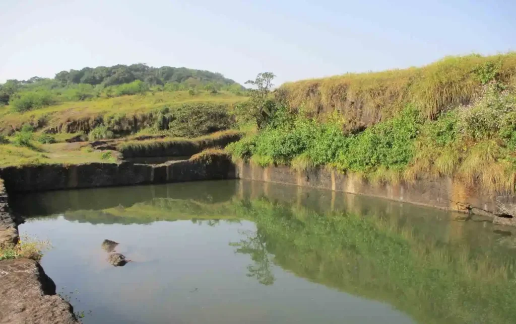
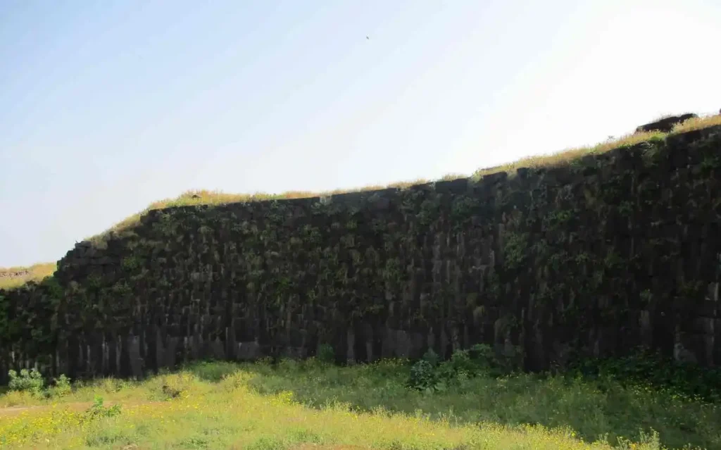
The fort is not one small structure where you enter through a gate, take a few photos and leave. There is a large open plateau with old fortification walls, ruined structures, water-storage areas and viewpoints spread around it.
I started roaming around slowly, clicking Visapur Fort photos with my camera and also taking some birthday pictures of myself.
And yes, after suffering through the trek in jeans just for good photos, I was definitely going to use that camera.
But something else started happening while I explored.
I became curious about the ruins around me.
When you see an old fort from a distance, it is easy to think of it simply as another trekking destination. Once you stand between those walls, you start wondering who built them, what happened here and why such a massive structure was needed on top of a mountain.
That curiosity pushed me towards history.
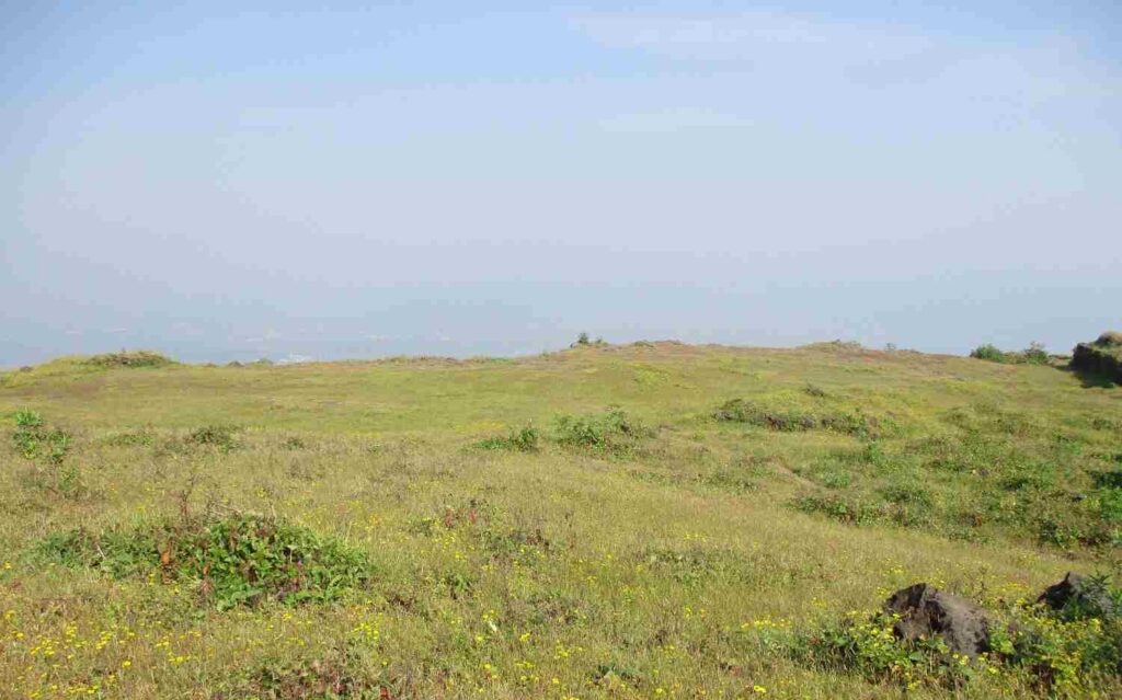
Sitting on the Fort and Reading Its History on a 2G Phone
I found a quiet place on top of Visapur Fort and sat there for some time.
Luckily, I was getting a little mobile network.
Remember, this was not the smartphone era for me. I had a basic 2G phone, so researching something online wasn’t as fast as it is today.
Still, I started searching about Visapur Fort history.
And slowly I began learning what this place actually represented.
Visapur Fort is generally dated to the early 18th century and is associated with Balaji Vishwanath, the first Peshwa of the Maratha Empire. It stands higher than neighbouring Lohagad and later became strategically important during the British campaign in this region.
The Pune District Gazetteer records that British forces took Visapur on 4 March 1818, followed by Lohagad the next day. (Maharashtra Tourism)
Reading history while actually sitting inside the place felt completely different from reading the same information at home.
The broken walls around me were no longer simply ruins.
There was a story behind them.
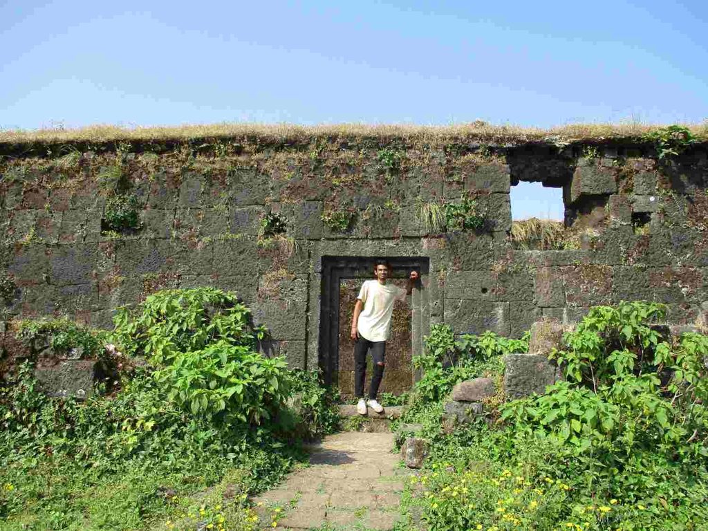
Why Maharashtra’s Forts Became Special to Me?
I have always admired Chhatrapati Shivaji Maharaj, and travelling around Maharashtra made me even more interested in learning about the state’s forts and history.
Visapur belongs mainly to the later Peshwa period, so I don’t want to incorrectly connect every structure here directly with Shivaji Maharaj. But visiting forts like this made me curious about the larger Maratha history and the incredible fort network spread across Maharashtra.
My mother tongue is Telugu, but I was born and brought up in Maharashtra. A lot of my early life, education and travel memories are connected with this state.
Maharashtra also taught me a lot through travelling.
Independence.
Confidence.
Trekking.
History.
And most importantly, how much there is to see when you stop spending every free day inside your room.
That is probably why this Visapur Fort trek became much more than simply another place on my list.
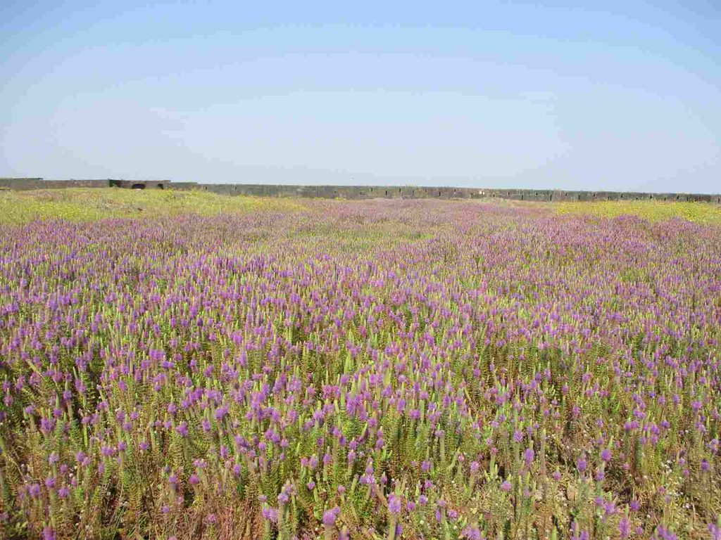
Celebrating My Birthday at Visapur Fort
Then I remembered the actual reason this particular day was special.
It was my birthday.
There was no cake.
No birthday decoration.
No restaurant.
No big celebration.
I was sitting on the top of a fort after waking up at 2 AM, travelling alone by local train, walking from Malavli, getting lost on the trekking trail and somehow making it all the way to the summit.
And I felt genuinely happy.
I think that was one of the first times I understood that a good birthday doesn’t necessarily need a big celebration.
Sometimes you only need to spend the day doing something that matters to you.
For me, reaching Visapur Fort alone was enough.
I sat quietly for some time and looked at the surrounding Sahyadri hills.
There was this feeling of freedom that is difficult to describe.
After years of studying engineering and constantly thinking about education, career and what would happen next, sitting on that fort made everything feel quiet for a while.
There are so many things I still want to do in life.
And travel is definitely one of them.
This birthday somehow gave me a new tradition too.
After this trip, travelling around my birthday became something I genuinely looked forward to.
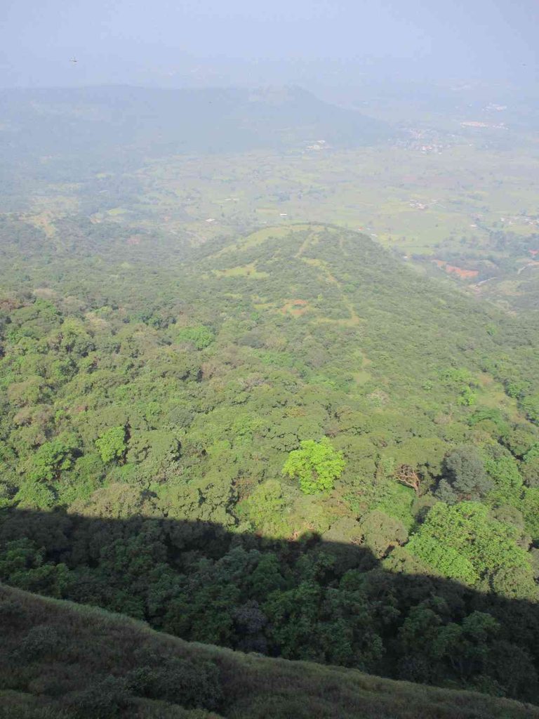
Why I Love Maharashtra Between Monsoon and Winter?
One thing I realised during these trips is just how beautiful Maharashtra becomes around the monsoon and post-monsoon season.
The Sahyadri region changes completely.
Green hills, waterfalls, fog, clouds and old forts suddenly make even the journey itself interesting.
Personally, I especially love travelling around Maharashtra from the monsoon into the cooler months.
However, monsoon trekking also comes with extra risks. Rocks become slippery, visibility can drop quickly and water can flow directly over trekking paths. So the scenery may look amazing in photos, but proper footwear and careful planning matter much more during this period.
After my jeans-and-canvas-shoes experiment, trust me, I learned that lesson properly.
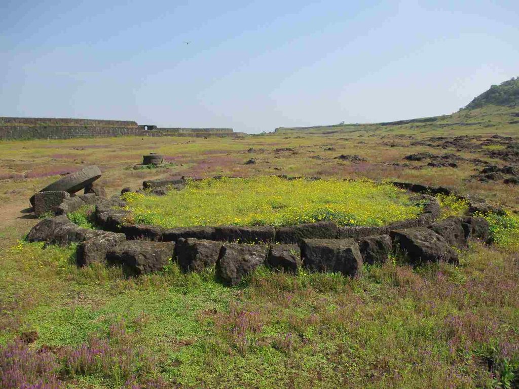
Starting My Descent From Visapur Fort
After spending a good amount of time exploring the fort, clicking photos and simply enjoying the surroundings, I decided it was time to descend.
But I didn’t return using exactly the same trail that I had taken while climbing.
Some people I met there suggested another route.
They also told me something interesting.
“If you have time, visit Bhaja Caves.”
I had already heard the name, but Bhaja Caves wasn’t really the main purpose of this trip.
My plan had been simple:
Pune → Malavli → Visapur Fort → return.
But when someone told me that Bhaje Caves were nearby, I started thinking again.
My legs were already tired.
I still had to reach Malavli Railway Station.
And after everything I had done since 2 AM, the sensible decision probably would have been to go directly back.
Then another thought came into my mind.
What if I don’t come to this area again anytime soon?
That was enough.
I decided to visit Bhaja Caves too.
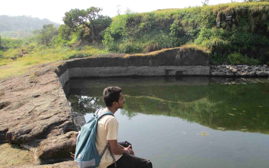
How Many Routes Are There for the Visapur Fort Trek?
During my visit, locals and other trekkers mentioned different approaches to Visapur Fort.
I had climbed from the Patan village side, while other trekkers were coming through the more commonly used Bhaja/Lohagadwadi side.
This is worth understanding before your trip because when people search for the Visapur Fort trek distance, they often see different answers.
That’s mainly because everyone is not necessarily starting from the same place.
For example, documented trekking guides estimate the Patan route and Bhaje-side route differently, and your total walking distance also changes depending on where your vehicle or auto drops you.
So I wouldn’t look at one random number online and assume every Visapur Fort trek is exactly that distance.
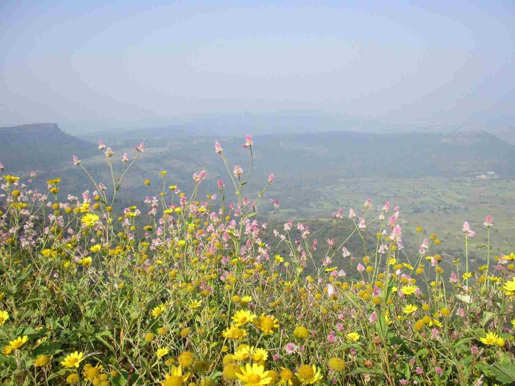
Walking From Visapur Fort Towards Bhaja Caves
After descending, I stopped for some water and gave my legs a little rest.
I was tired.
Very tired.
But I had already made my decision.
So I started walking towards Bhaja Caves.
From what I remember from my route that day, the caves felt roughly around 3 km away after my descent, but I wasn’t tracking the walk using GPS. The exact distance depends on which Visapur route you descend from.
For a more useful reference, Maharashtra Tourism currently places Malavli Railway Station about 2 km from Bhaja Caves. (Maharashtra Tourism)
So if you’re visiting only Bhaja Caves by public transport, Malavli is one of the most convenient railway stations.
For me, however, this was not a fresh 2 km morning walk.
This was after climbing Visapur Fort.
My legs definitely knew the difference.
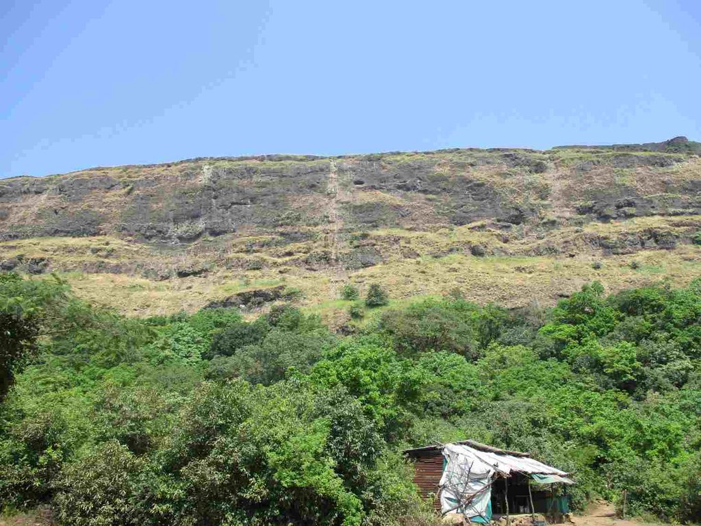
Finally Reaching Bhaja Caves
Eventually, I reached Bhaje Caves.
At the entrance, there was a ticket counter.
I don’t remember the exact ticket price now, but I remember paying somewhere around ₹20 at the time of my visit.
Please treat that only as my old trip expense, not today’s confirmed entry fee. Ticket prices can change, so check the current rate before your visit.
After buying the ticket, I entered the cave complex.
And once again, I had reached a place without properly understanding how old it actually was.
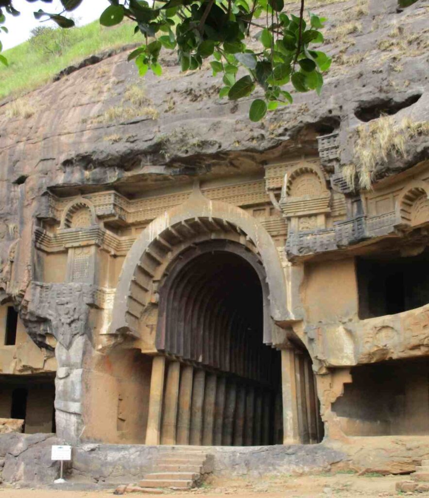
Bhaja Caves History: Much Older Than Visapur Fort
This surprised me.
Visapur Fort is a few hundred years old.
But Bhaja Caves are more than two thousand years old.
Maharashtra Tourism dates the caves to around the 2nd century BCE and describes them as some of India’s earliest Buddhist rock-cut structures. The complex contains 22 rock-cut caves, including prayer halls and residential spaces associated with Buddhist monks. (Maharashtra Tourism)
That completely changed how I looked at them.
These weren’t simply holes carved into a mountain.
People had carefully created religious and residential spaces inside solid rock more than 2,000 years ago.
The caves were positioned near an ancient trade route connecting the Arabian Sea side with the Deccan Plateau. Their location meant the area was connected not only with Buddhist monastic life but also with travellers moving through this important route. (Maharashtra Tourism)
For someone already tired after an entire fort trek, suddenly discovering this kind of history gave me another burst of energy.
The Chaitya Hall Was My Favourite Part
The most impressive part for me was seeing the main prayer hall.
One of Bhaja’s most important structures is Cave 12, the chaityagriha, an early Buddhist prayer hall.
Inside, a stupa sits at the far end while stone pillars run along the sides.
The roof is particularly interesting because its curved form preserves features inspired by earlier wooden architecture. Maharashtra Tourism highlights these architectural elements as an important example of how early Buddhist rock-cut construction developed. (Maharashtra Tourism)
Imagine carving a hall like this into solid rock more than two thousand years ago.
No modern cutting machines.
No electric equipment.
And yet the geometry and structure are still visible today.
This is where Bhaja Caves photos sometimes don’t communicate the complete experience.
A photo will show the arch, pillars and stupa.
Standing inside makes you think about the amount of human work that went into creating it.
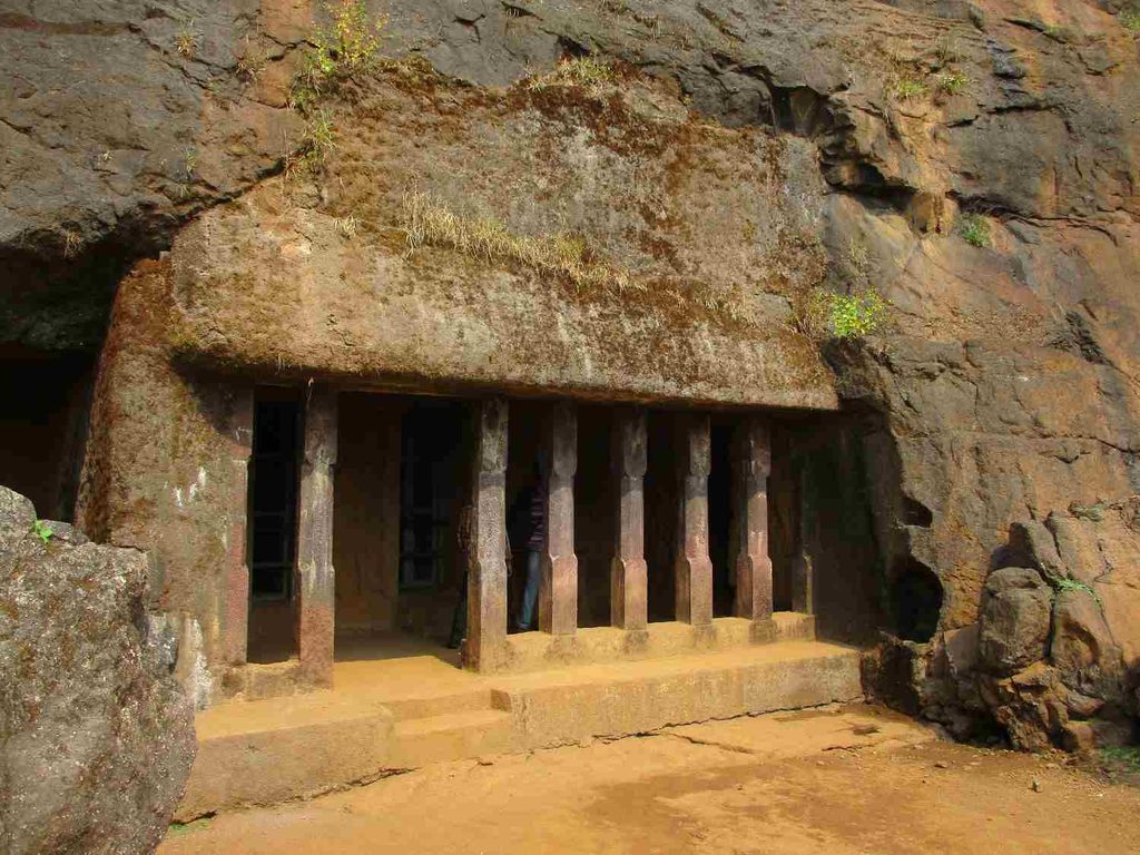
Chaityas, Viharas and Ancient Stupas
As I continued exploring, I learned that the caves did not all serve the same purpose.
Some spaces were chaityas, which were used as prayer halls.
Others were viharas, which provided accommodation and living spaces for Buddhist monks.
The complex also contains stupas, water cisterns and carvings, giving an idea of how organised the settlement once was.
The Government of India’s Incredible India portal describes the 22-cave complex as a protected historical site and notes its importance as an early example of Buddhist cave architecture. (Incredible India)
That makes Bhaja much more than a quick sightseeing stop near Lonavala.
If you enjoy history, I would spend some time looking at the smaller details instead of only taking photos of the main cave and leaving.
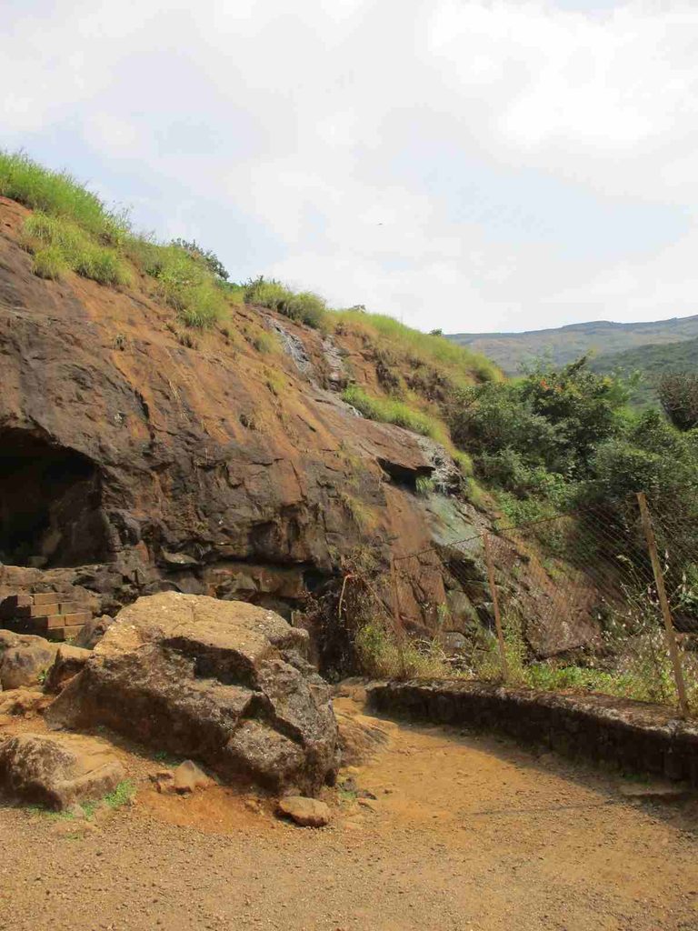
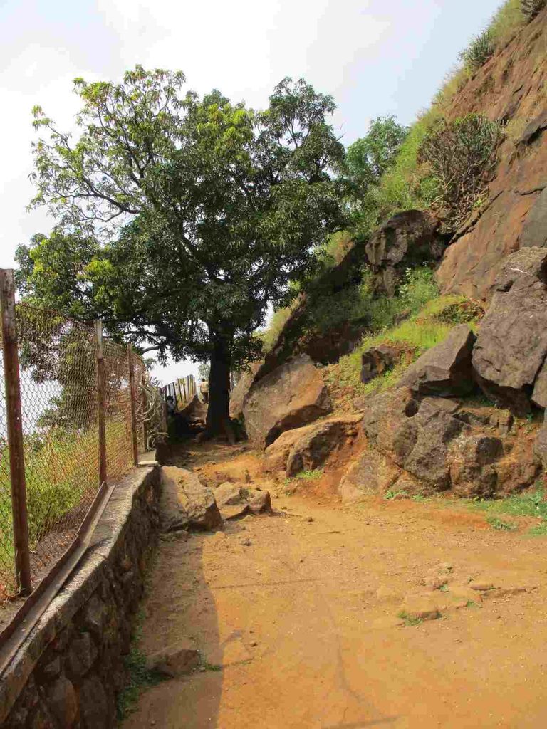
How Much Time Do You Need at Bhaja Caves?
From my experience, around 30 minutes to 1 hour is enough for most travellers.
I spent roughly an hour because I was exploring slowly and reading a little about the history.
If you’re visiting solo and only want to see the main caves and click some Bhaja Caves photos, you may finish within 30–45 minutes.
But if you like architecture or history, give yourself longer.
The physical cave complex isn’t enormous, so you don’t necessarily need half a day.
For me, this was perfect because I had already completed the Visapur trek earlier.
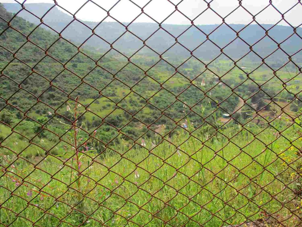
Karla and Bhaja Caves in Lonavala
Another useful thing to know is that Karla and Bhaja Caves Lonavala can easily be considered together if ancient Buddhist architecture interests you.
Both belong to the wider collection of early rock-cut Buddhist sites around the Lonavala region. Maharashtra Tourism specifically groups Karla, Bhaja and Bedse among the historically important caves in this part of Maharashtra. (Maharashtra Tourism)
I didn’t visit Karla Caves on this particular trip because my body had already given me enough warnings for one birthday.
Visapur Fort plus Bhaja Caves was enough.
But if you’re coming by vehicle and have additional time, Karla Caves can be added to the same itinerary.
Bhaja Caves to Karla Caves Distance
The Bhaja Caves to Karla Caves distance is roughly 7 km by road, depending on your exact route. Current route estimates put the driving distance at about 7.3 km. (Rome2Rio)
So it is possible to combine both.
However, if you’re travelling entirely on foot after completing the Visapur trek like I was, trying to add everything on the same day can become exhausting.
That’s why I skipped Karla.
Sometimes travelling is also about knowing when to stop.
Are Bhaja Caves Worth Visiting?
If someone asks me for a simple Bhaja Caves review, my answer would be based on what type of traveller you are.
Don’t go there expecting something as huge as Ajanta or Ellora.
Bhaja is much smaller.
But that’s also part of its charm.
You can explore an archaeological site more than 2,000 years old without needing an entire day.
For history lovers, photographers and people already visiting Visapur or Lohagad, Bhaja Caves are absolutely worth adding to the route.
For me, the caves became an unexpected bonus destination.
I had started the day thinking only about Visapur Fort.
By afternoon, I was walking through one of the oldest groups of caves in Lonavala.
That is what I love about unplanned travel.
Sometimes the place you didn’t plan becomes one of the best parts of the trip.
Back to Malavli Railway Station
After spending around one hour exploring Bhaja Caves, I finally started walking back towards Malavli Railway Station.
At this point, I had almost no energy left.
Just think about my day until then.
I had woken up at 2 AM, travelled from Wagholi to Pune Railway Station, taken the Pune-Lonavala local, walked towards Patan village, climbed Visapur Fort for around two and a half hours, explored the fort, descended through another route, walked to Bhaja Caves and explored them too.
My birthday celebration had turned into a full-day endurance test.
By the time I reached Malavli Railway Station, I was extremely hungry.
There was a small shop near the station, so I ordered the most appropriate Maharashtra trekking meal possible.
Vada pav.
Then I had some lassi too.
Together, they cost me around ₹50 at the time.
That vada pav tasted better than any birthday cake I could have ordered.
Malavli to Chinchwad Instead of Going Home
Normally, this should have been the point where I caught a train back to Pune and ended the trip.
But apparently I had decided that this birthday wasn’t tiring enough yet.
Some of my school friends were staying in Chinchwad for their MBA studies, and I hadn’t met them for quite some time.
Since I was already travelling on the same side, I decided to meet them.
I bought a Malavli-to-Chinchwad local train ticket.
It cost me around ₹10 at that time.
I waited for the local and eventually got inside.
I took a window seat.
After that, I barely remember the journey.
I was so tired that it felt like I closed my eyes for a moment and suddenly Chinchwad station had arrived.
Meeting My School Friends After the Trek
I got down at Chinchwad at around 6 PM, and my friend came to pick me up from the station.
Meeting school friends after a long gap has a different feeling.
You can be busy with college, jobs or life for months, but when you finally meet, somehow old conversations return very quickly.
We talked about random things, caught up on what everyone was doing and later had dinner.
By then my body had completely given up.
I went to sleep without needing anyone to tell me twice.
My birthday started alone at 2 AM.
It ended with old school friends.
I don’t think I could have planned it better.
Journey Back to My Hostel
The following morning I woke up, freshened up and went back to Chinchwad Railway Station.
I purchased a ticket to Pune Junction, which cost me around ₹5 at that time.
From Pune Station, I took a PMPML bus towards Wagholi for around ₹45.
Then I took a shared auto from Wagholi to BJS Phata for approximately ₹20.
Finally, I reached my hostel.
I put my things down.
Got onto the bed.
And slept.
Not for one hour.
Not for three hours.
I slept for nearly 12 hours.
That should tell you everything about how tired I was.
What This Birthday Trip Changed for Me?
When I look back at this trip, I don’t remember it because everything went perfectly.
Actually, plenty went wrong.
I couldn’t sleep properly because of excitement.
My train was delayed.
I had no Google Maps.
I wore the wrong clothes.
I got lost during the trek.
My legs hurt.
I exhausted myself by adding Bhaja Caves afterward.
But I completed it.
And I enjoyed it.
Visapur Fort pushed that confidence one step further.
Travel slowly started becoming more than a weekend activity for me.
Every trip was teaching me something new.
Devkund taught me that I could travel solo.
Visapur taught me to trust myself but also respect a trekking route.
Bhaja Caves reminded me that a place you almost skip can sometimes surprise you with thousands of years of history.
And Visapur taught me one final lesson that I definitely haven’t forgotten:
Never choose jeans and canvas shoes for a trek just because you want good birthday photos.
That birthday didn’t have a cake at the top.
But even today, I remember the climb, that view and that feeling of reaching the fort alone much more clearly than most normal birthday celebrations.
And maybe that’s why, after Visapur, I started wanting to travel somewhere whenever my birthday came around.
Complete Visapur Fort Trek Guide
After sharing my birthday journey, getting lost on the trail, reaching Visapur Fort, and later exploring Bhaja Caves, this section is for anyone who wants to actually plan the same trip.
My experience was completely dependent on local trains, walking and asking people for directions because I didn’t have a proper smartphone at that time. Today, planning the Visapur Fort trek is much easier, but you still need to understand which trekking route you are taking.
That part is important because Visapur has more than one approach, and this is also why you will find different answers online for the trek distance and duration.
Where Is Visapur Fort?
Visapur Fort is located in Maval taluka of Pune district, Maharashtra, near Malavli and Lonavala. It forms part of the Lohagad-Visapur fortification and stands on the same hill system as neighbouring Lohagad Fort.
The nearest convenient railway station for trekkers is Malavli Railway Station, which makes Visapur one of the easier Sahyadri forts to reach from Pune without a private vehicle.
The fort stands at approximately 1,084 metres above sea level, which is around 3,556 feet or 1.084 km in elevation. It is slightly higher than Lohagad Fort, which Maharashtra Tourism lists at 1,033 metres. (Wikipedia)
Visapur Fort Quick Facts
| Information | Details |
| Fort | Visapur Fort |
| District | Pune |
| Taluka | Maval |
| State | Maharashtra |
| Nearest town | Lonavala |
| Nearest railway station | Malavli |
| Visapur Fort height | Approx. 1,084 m / 3,556 ft |
| Trek difficulty | Easy to moderate / moderate depending on route and weather |
| Main base areas | Bhaje, Patan and Lohagadwadi/Gaimukh Khind |
| Popular trek season | Monsoon and post-monsoon |
| Bhaje-route trek distance | Approx. 8 km round trip |
| Patan-route trek distance | Approx. 6 km round trip |
| Time required | Around half to full day |
| Fort type | Hill fort |
| Historical period | Early 18th century, Peshwa era |
Visapur Fort Distance From Pune
The Visapur Fort distance from Pune is roughly 57 to 65 km, depending on where in Pune you start and which road you use to reach the trekking base.
Rome2Rio currently calculates approximately 56.8 km by road, while trekking guides commonly round the Pune-to-Visapur distance to around 65 km. (Rome2Rio)
For most travellers, I would keep around 1.5 to 2 hours for the road journey, and more during weekends, rain or heavy traffic.
In my case, I didn’t travel directly by road. I travelled from Pune Railway Station to Malavli by local train because I was travelling on a very tight budget.
Visapur Fort Distance From Major Cities
These distances are useful for understanding where Visapur sits geographically. Road distances can change slightly depending on your starting point and chosen route.
| Starting Place | Approx. Distance | Planning Advice |
| Pune | 57–65 km | Easy day trip |
| Mumbai | Around 105–110 km | Start early |
| Lonavala | Roughly 15–25 km depending on access road | Convenient base |
| Malavli | Around 3–6 km to the trekking approach | Best rail access |
| Hyderabad | Around 600 km | Better as an overnight/multi-day trip |
| Warangal | Around 750–760 km to Lonavala region | Train or multi-day road trip |
| Karimnagar | Roughly 750+ km depending on route | Better via Pune/Lonavala with overnight stay |
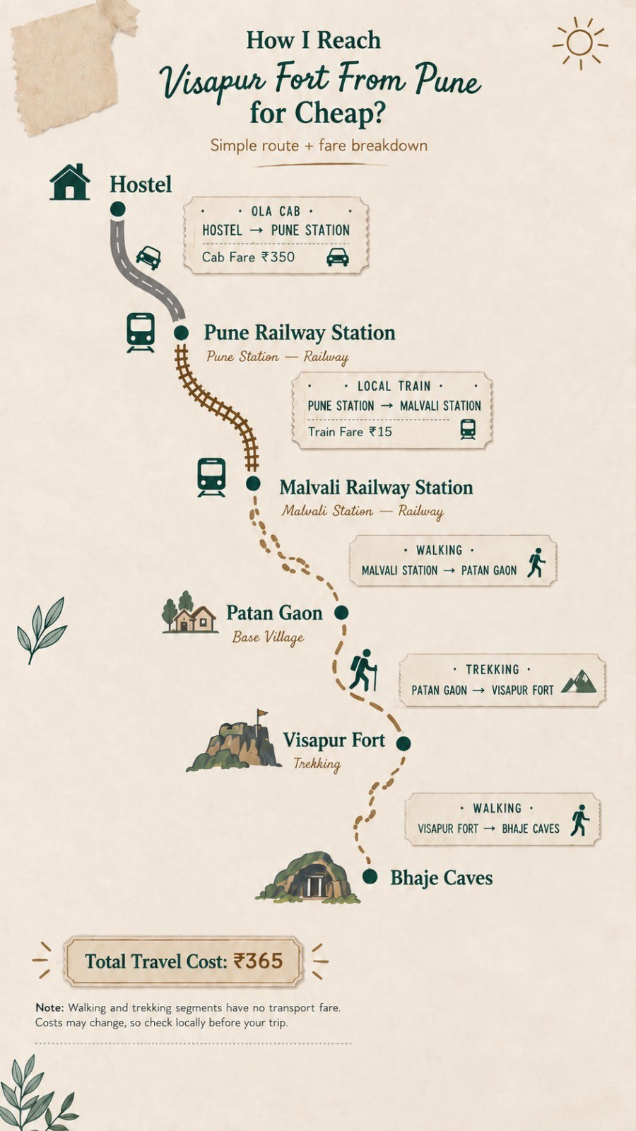
How to Reach Visapur Fort From Pune by Train?
For budget travellers, this is still one of the most practical ways to reach the area.
You can travel from Pune towards Lonavala/Malavli, get down at Malavli Railway Station and then continue towards your chosen trek base.
This was exactly what I did.
During my trip, my Pune-to-Malavli local ticket cost only ₹15, but that was the fare at the time of my visit. Don’t use my old amount as the present railway fare.
Train timings and ticket prices change, so check the latest local train schedule before travelling.
Three Main Visapur Fort Trek Routes
This was something I understood much better after my trip.
When I was there, local people told me there were multiple ways to reach the fort. Current trekking references generally identify three main approaches: Bhaja/Bhaje route, Patan village route and Gaimukh Khind route from the Lohagadwadi side.
Route 1: Bhaje Village Route
This is usually the easiest route to understand for a first-time visitor.
IndiaHikes considers Bhaje village the primary route. Their documented route is approximately 4 km one way, or around 8 km for the complete up-and-down trek. (Indiahikes)
The trail is more commonly used and easier to follow compared with Patan.
If I were visiting Visapur for the first time today without knowing the area, this is the kind of route I would prefer over trying to repeat my old adventure of randomly asking people for directions.
You can also combine this route with Bhaja Caves, which makes it useful if you want history and trekking in the same trip.
Route 2: Patan Village Route
This is the route connected closest to my personal experience.
After leaving Malavli, I walked towards Patan village and asked locals for directions.
IndiaHikes estimates the Patan route at approximately 3 km each way, or roughly 6 km round trip. However, they also describe it as less clearly marked than the Bhaje route. (Indiahikes)
That matches my experience almost perfectly.
I actually lost the trail while climbing.
At that time, there weren’t people everywhere, I didn’t have Google Maps and I was still new to trekking. For a few minutes I was genuinely scared because I had no idea where the correct trail was.
Eventually, I heard other trekkers and followed their direction.
So although the Visapur Fort trek distance through Patan can be shorter, shorter does not automatically mean easier for a beginner.
Route 3: Gaimukh Khind / Lohagadwadi Route
The third option approaches Visapur from the Lohagad side through Gaimukh Khind.
This is also the route people usually mean when discussing the Visapur Fort Lohagad trek road Malavli Maharashtra combination.
At Gaimukh Khind, the routes divide towards the two forts. Trekking sources describe the Visapur side as the famous waterfall route during the monsoon, while the other direction continues towards Lohagad. (Treks and Trails India)
This route can be comparatively short, but during rain you may literally be climbing over rocks with water running across them.
That looks amazing in Instagram reels.
It also becomes slippery.
Treat those two facts with equal importance.
Which Visapur Fort Trek Route Should You Choose?
| Route | Approx. Distance | Navigation | Best For |
| Bhaje Village | ~8 km round trip | Easier to follow | First-time trekkers |
| Patan Village | ~6 km round trip | Can be confusing | Experienced/alert trekkers |
| Gaimukh Khind | Shorter ascent | Popular waterfall approach | Monsoon experience & Lohagad combination |
Personally, I would choose the Bhaje route for a first solo visit.
My Patan experience was memorable, but getting lost alone is not something I would recommend recreating just for the adventure.
Visapur Fort Trek Difficulty Level
If you’re searching for the Visapur Fort trek difficulty level, I would describe it as:
Moderate for an average beginner, but potentially more difficult during heavy monsoon conditions.
But fitness still matters.
My own experience felt much harder because I was a beginner, had already walked several kilometres, chose the Patan side, got lost and made the wonderful decision to wear jeans and canvas shoes.
So difficulty ratings on websites are only one part of the answer.
Your footwear, weather, fitness and chosen route matter just as much.
Visapur Fort Trek Distance in KM
There isn’t one universal answer for Visapur Fort trek distance in km because there are multiple starting points.
For planning purposes:
Bhaje route: roughly 8 km round trip.
Patan route: roughly 6 km round trip.
A combined Visapur-Lohagad trek can become considerably longer depending on your start/end points and how much of both plateaus you explore. (Indiahikes)
Also remember that these numbers usually describe the actual trekking portion.
If you walk all the way from Malavli Railway Station as I did, your total walking distance for the day will be much higher.
And if you add Bhaja Caves afterward, your legs will definitely know about it.
Can You Do Visapur Fort and Lohagad Together?
Yes.
Visapur and Lohagad are neighbouring forts, and experienced trekkers regularly combine them.
The forts appear very close geographically, although road-navigation apps can show strangely long driving distances because there is no direct motorable road connecting the two summits. Trekking routes use the saddle/Gaimukh Khind area instead. One recent trekking guide estimates a combined Visapur-Lohagad loop at roughly 8–10 km, requiring around 6–8 hours including exploration time. (TrekGo)
If you’re a beginner, however, I wouldn’t add Lohagad simply because it appears nearby on the map.
Complete Visapur first.
See how your body feels.
Then decide.
Nearby Places to Visit Around Visapur Fort
One advantage of this location is that several attractions sit within the wider Malavli-Lonavala region.
| Nearby Place | Approx. Distance/Context | Why Visit |
| Bhaja Caves | ~2 km from Malavli station | 2nd-century BCE Buddhist caves |
| Lohagad Fort | ~5 km trek from Malavli side | Historic fort and easy trek |
| Karla Caves | Short drive from Bhaja/Lonavala region | Ancient Buddhist chaitya complex |
| Lonavala | ~12–20 km depending on your point | Food, accommodation and hill-station sightseeing |
| Pawna Lake | Short drive from the fort region | Lake views and camping |
| Bedse Caves | Within the wider Maval region | Quieter ancient Buddhist caves |
Bhaja Caves to Karla Caves Distance
If you’re interested in Karla and Bhaja Caves Lonavala, both are worth seeing because they represent important Buddhist rock-cut architecture in this region.
The Bhaja Caves to Karla Caves distance is only a few kilometres geographically, although the actual road journey can be longer depending on the access route.
Maharashtra Tourism describes Karla as a short distance from Bhaja and specifically recommends combining the two heritage sites. (Maharashtra Tourism)
I personally stopped at Bhaja because I had already completed the Visapur trek and walked almost everywhere that day.
Adding Karla too would have been too much for me.
Best Time to Visit Visapur Fort
For scenery, the monsoon from roughly June to September is the most dramatic period.
This is when you usually see the green Sahyadri landscape and the famous water flowing over parts of the trekking trail.
But monsoon also means wet rocks, mud, fog, reduced visibility and potentially stronger water flow.
Personally, I also love the post-monsoon period in Maharashtra because the surroundings remain green while trekking conditions can become more manageable.
If your priority is comfortable trekking rather than waterfalls, October to early winter can be a very good alternative.
What Should You Carry for the Visapur Fort Trek?
After what happened on my birthday trek, my first recommendation is obvious.
- Wear trekking or sports shoes with good grip, comfortable quick-dry clothing, and avoid jeans if possible. Carry enough drinking water, some light food or energy snacks, rain protection during monsoon, a charged phone and power bank, basic first aid, some cash, and ideally an offline map if you’re taking a less familiar route. Start early, especially on weekends, and don’t continue blindly if you lose the trail.
Yes, I learned several of those lessons personally.
Food and Water
Don’t depend completely on finding food on the fort.
Availability around the base villages can change by season and weekday.
During popular weekends and monsoon periods you may find local stalls around frequently used routes, but I still prefer carrying my own drinking water and at least some emergency food.
After finishing my own trek and Bhaja Caves visit, I was extremely hungry.
The vada pav and lassi I ate near Malavli Railway Station cost me around ₹50 at the time, and after that amount of walking, it tasted better than most restaurant meals.
My Actual Visapur Fort Trip Budget
This is my historical trip budget, not a current price estimate.
| Expense | What I Paid |
| Ola: BJS Phata to Pune Station | ~₹350 |
| Pune to Malavli local train | ₹15 |
| Bhaja Caves entry | Around ₹20 from memory |
| Food at Malavli | ~₹50 |
| Malavli to Chinchwad train | ₹10 |
| Chinchwad to Pune train next day | ₹5 |
| Pune Station to Wagholi PMPML | ₹45 |
| Wagholi to BJS Phata shared auto | ₹20 |
| Approx. total remembered cost | ₹515 |
₹515 for a birthday that I still remember years later?
For me, that was money well spent.
Practical One-Day Visapur Fort Itinerary
If I were planning a straightforward trip today, I would reach Malavli early in the morning, continue towards Bhaje or the selected trek base, start climbing before the weather becomes hot, spend enough time exploring the Visapur plateau, descend by early afternoon and then visit Bhaja Caves only if I still had enough energy.
If you’re planning Visapur + Lohagad, I would keep almost the entire day free rather than adding Bhaja and Karla Caves too.
Trying to cover every pin on Google Maps usually turns a good trip into a race.
My own Visapur + Bhaja day was already enough to make me sleep for almost 12 hours afterward.
My Visapur Fort Review
My Visapur Fort review is probably different from someone who simply drove to the base, followed a trekking group and returned.
For me, this trip was connected with a specific stage of my life.
My engineering degree had just ended.
I was trying to understand what I wanted to do next.
My first solo Devkund trip had already given me confidence, but Visapur tested that confidence much more.
I travelled alone on my birthday.
I woke up at 2 AM.
I travelled with a basic Nokia phone.
I asked strangers for directions.
I got lost.
I became completely exhausted.
And I still reached the top.
The fort itself is beautiful, especially when Maharashtra turns green. But what stayed with me wasn’t only the scenery.
It was the feeling I had while sitting on top and realising:
I came here alone, and I actually did it.
That experience pushed me further into travelling and trekking.
If you enjoy reading my Maharashtra trekking experiences, you can also check my solo Devkund Waterfall trek, which gave me the confidence to start travelling alone, and my Lingana Fort trek, where the adventure later became much more serious with rope climbing and rappelling.
Final Thoughts on My Visapur Fort Birthday Trek
When I started from my hostel at 2 AM, I only wanted to do something different on my birthday.
I didn’t know that this trip would become one of those experiences I would remember years later.
My train got delayed.
I walked kilometres without Google Maps.
I got lost during the trek.
I discovered why jeans are a terrible trekking choice.
I somehow completed Visapur Fort, explored Bhaja Caves, ate vada pav at Malavli, met my school friends in Chinchwad and finally returned to my hostel the following day.
Then I slept for almost 12 hours.
It wasn’t a perfect trip.
That is exactly why I remember it.
After successfully completing my earlier Devkund trip and then this birthday trek, solo travel slowly stopped feeling impossible to me.
It became something I wanted to continue.
And that is exactly what happened.
From that phase of my life, birthdays became less about sitting in one place and more about creating one new travel memory whenever I could.
If you’re planning Visapur Fort, prepare properly, choose your route carefully and give yourself enough time. Don’t only go there for the waterfall photos you see online. Walk around the fort, understand a little of its history and look at the neighbouring Sahyadri landscape.
That is where the real Visapur experience begins.
Frequently Asked Question
What is the Visapur Fort distance from Pune?
The Visapur Fort distance from Pune is approximately 57–65 km, depending on your starting point and route. By road, keep roughly 1.5–2 hours under normal conditions, while public-transport travellers can use trains towards Malavli/Lonavala.
What is the Visapur Fort height?
Visapur Fort height is approximately 1,084 metres above sea level, equivalent to about 3,556 feet or 1.084 km. It stands slightly higher than neighbouring Lohagad Fort.
What is the Visapur Fort trek difficulty level?
The Visapur Fort trek difficulty level is generally easy-to-moderate or moderate. Fit beginners can attempt the commonly used Bhaje route, but rain, slippery rocks and route-finding can increase the difficulty considerably.
What is the Visapur Fort trek distance?
The Visapur Fort trek distance depends on your route. Roughly 8 km round trip through Bhaje village and approximately 6 km round trip through Patan village.
Which railway station is closest to Visapur Fort?
Malavli Railway Station is the most convenient railway access point for Visapur, Bhaja Caves and Lohagad. Travellers from Pune or the Lonavala side can reach Malavli and continue towards their selected trek base.
Is Visapur Fort better in the monsoon?
The monsoon gives Visapur its most famous appearance with green hills, mist and flowing water on parts of the trail. But the same conditions make rocks slippery and navigation harder. If photography and waterfalls matter most, monsoon is excellent. If easier trekking matters more, consider the post-monsoon period.

Solo traveller, biker, and explorer sharing honest travel guides, hidden places, and unforgettable road trips across India.